Sibigo geodata
Sibigo (Aceh) is a seat of a third-order administrative division; located in Indonesia in Asia/Jakarta (GMT+7) time zone. In our database, there are 407 cities with bigger population. Compared to other cities in Indonesia, 97.8% of cities are located further ↓South; 99.7% of cities are located further →East and 92.1% of cities have higher elevation than Sibigo. Note1


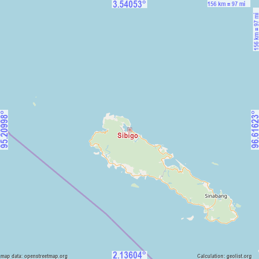
Sibigo GPS coordinates[2]
2° 50' 18.6" North, 95° 54' 47.16" East
| Map corner | latitude | longitude |
|---|---|---|
| Upper-left | 3.54053°, | 95.20998° |
| Center: | 2.8385°, | 95.9131° |
| Lower-right: | 2.13604°, | 96.61623° |
| Map W x H: | 156.2×156.2 km | = 97.1×97.1mi |
| max Lat: | 5.88969° ⇑2.2% North |
| Sibigo: | 2.8385° |
| min Lat: | ⇓97.8% South -10.934° |
| min Long | Sibigo | max Long |
| 95.1345° | 95.9131° | 140.9419° |
| W 0.3%⇐ | ⇒99.7% E |
Elevation
Elevation of Sibigo is 9 m = 30 ft, and this is 220.7 m = 724 ft below average elevation for this country.
| Max E: |
3185 m = 10449 ft | 92.1% |
| Avg. | 229.7 m = 754 ft | |
| Sibigo | 9 m = 30 ft | |
Min E: |
-1 m = -3 ft | 7.9% |
See also: Indonesia elevation on elevation.city.
Geographical zone
Sibigo is located in North Torrid zone (between Equator and Tropic of Cancer). Distance of Equator is 315.6 km =196.1 mi to South.| Distance of | km | miles | from Sibigo |
|---|---|---|---|
| North Pole | 9691.5 | 6022 | to North |
| Arctic Circle | 7085.6 | 4402.8 | to North |
| Tropic Cancer | 2290.3 | 1423.1 | to North |
| Equator | 315.6 | 196.1 | to South |


Nearby cities:
15 places around Sibigo: (largest is in red/bold)
• Blangpidie
143.3 km =89 mi,  45°
45°
• Kota Trieng
143.9 km =89.4 mi, 54°
• Kotabahagia
144.4 km =89.7 mi,  40°
40°
• Kuala Tuha
140.6 km =87.4 mi,  15°
15°
• Labuhan Bajau
77.4 km =48.1 mi,  128°
128°
• Lauke
31.7 km =19.7 mi,  153°
153°
• Luan Balu
58.1 km =36.1 mi, 126°
• Meukek
146 km =90.7 mi,  60°
60°
• Peuleumat
145.8 km =90.6 mi, 58°
• Samadua
146.1 km =90.8 mi,  67°
67°
• Sawang
146.1 km =90.8 mi, 64°
• Sinabang
65.4 km =40.6 mi, 127°
• Suek
144.7 km =89.9 mi, 43°
• Susoh
140.9 km =87.6 mi, 45°
• Tangantangancut
143.7 km =89.3 mi, 48°
Sources, notices
• [Note1] Compared only with cities in Indonesia existing in our database
• [Src1] Map data: © OpenStreetMap contributors (CC-BY-SA)
• [Src2] Other city data from geonames.org with taken over terms of usage.
• [Src3] Geographical zone / Annual Mean Temperature by Robert A. Rohde @ Wikipedia
