Sepatan geodata
Sepatan (West Java) is a populated place; located in Indonesia in Asia/Jakarta (GMT+7) time zone. With population of 118,439 people, there are 110 cities with bigger population in this country. Compared to other cities in Indonesia, 87.9% of cities are located further ↓South; 87.2% of cities are located further →East and 89% of cities have higher elevation than Sepatan. Note1


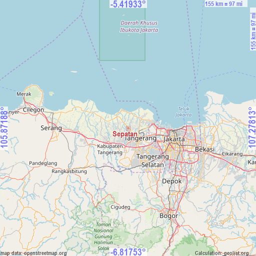
Sepatan GPS coordinates[2]
6° 7' 8.004" South, 106° 34' 30" East
| Map corner | latitude | longitude |
|---|---|---|
| Upper-left | -5.41933°, | 105.87188° |
| Center: | -6.11889°, | 106.575° |
| Lower-right: | -6.81753°, | 107.27813° |
| Map W x H: | 155.5×155.5 km | = 96.6×96.6mi |
| max Lat: | 5.88969° ⇑12.1% North |
| Sepatan: | -6.11889° |
| min Lat: | ⇓87.9% South -10.934° |
| min Long | Sepatan | max Long |
| 95.1345° | 106.575° | 140.9419° |
| W 12.8%⇐ | ⇒87.2% E |
Elevation
Elevation of Sepatan is 11 m = 36 ft, and this is 218.7 m = 718 ft below average elevation for this country.
| Max E: |
3185 m = 10449 ft | 89% |
| Avg. | 229.7 m = 754 ft | |
| Sepatan | 11 m = 36 ft | |
Min E: |
-1 m = -3 ft | 11% |
See also: Sepatan elevation on elevation.city.
Geographical zone
Sepatan is located in South Torrid zone (between Equator and Tropic of Capricorn). Distance of Equator is 680.4 km =422.8 mi to North.| Distance of | km | miles | from Sepatan |
|---|---|---|---|
| Equator | 680.4 | 422.8 | to North |
| Tropic Capricorn | 1925.6 | 1196.5 | to South |
| Antarctic Circle | 6720.8 | 4176.1 | to South |
| South Pole | 9326.7 | 5795.3 | to South |


Nearby cities:
15 places around Sepatan: (largest is in red/bold)
• Cikupa
15 km =9.3 mi,  209°
209°
• Ciputat
18.7 km =11.6 mi,  134°
134°
• Ciruas
37.8 km =23.5 mi,  268°
268°
• Curug
16.5 km =10.3 mi,  187°
187°
• Jakarta
31.7 km =19.7 mi,  109°
109°
• Kresek
21.6 km =13.4 mi, 266°
• Langgen
33.4 km =20.8 mi,  296°
296°
• Lontar
34.1 km =21.2 mi, 299°
• Pamulang
30.8 km =19.1 mi,  144°
144°
• Pasarkemis
7.6 km =4.7 mi,  220°
220°
• Serpong
24.1 km =15 mi,  155°
155°
• South Tangerang
24.6 km =15.3 mi, 140°
• Tangerang
9 km =5.6 mi, 137°
• Teluknaga
7.3 km =4.5 mi,  72°
72°
• Tigaraksa
13.9 km =8.6 mi, 209°
Sources, notices
• [Note1] Compared only with cities in Indonesia existing in our database
• [Src1] Map data: © OpenStreetMap contributors (CC-BY-SA)
• [Src2] Other city data from geonames.org with taken over terms of usage.
• [Src3] Geographical zone / Annual Mean Temperature by Robert A. Rohde @ Wikipedia
