Sampang geodata
Sampang (East Java) is a seat of a second-order administrative division; located in Indonesia in Asia/Jakarta (GMT+7) time zone. With population of 53,269 people, there are 221 cities with bigger population in this country. Compared to other cities in Indonesia, 55.7% of cities are located further ↓South; 60.4% of cities are located further ←West and 98.5% of cities have higher elevation than Sampang. Note1


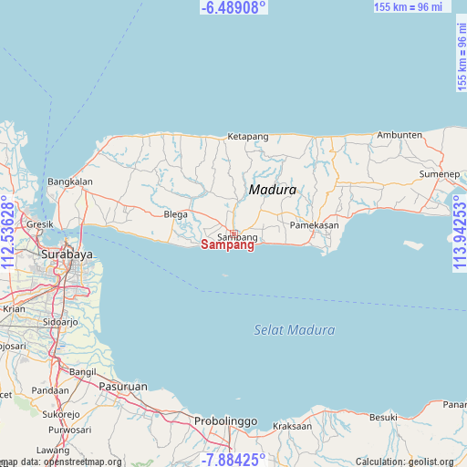
Sampang GPS coordinates[2]
7° 11' 13.92" South, 113° 14' 21.84" East
| Map corner | latitude | longitude |
|---|---|---|
| Upper-left | -6.48908°, | 112.53628° |
| Center: | -7.1872°, | 113.2394° |
| Lower-right: | -7.88425°, | 113.94253° |
| Map W x H: | 155.1×155.1 km | = 96.4×96.4mi |
| max Lat: | 5.88969° ⇑44.3% North |
| Sampang: | -7.1872° |
| min Lat: | ⇓55.7% South -10.934° |
| min Long | Sampang | max Long |
| 95.1345° | 113.2394° | 140.9419° |
| W 60.4%⇐ | ⇒39.6% E |
Elevation
Elevation of Sampang is 5 m = 16 ft, and this is 224.7 m = 737 ft below average elevation for this country.
| Max E: |
3185 m = 10449 ft | 98.5% |
| Avg. | 229.7 m = 754 ft | |
| Sampang | 5 m = 16 ft | |
Min E: |
-1 m = -3 ft | 1.5% |
See also: Sampang elevation on elevation.city.
Geographical zone
Sampang is located in South Torrid zone (between Equator and Tropic of Capricorn). Distance of Equator is 799.1 km =496.5 mi to North.| Distance of | km | miles | from Sampang |
|---|---|---|---|
| Equator | 799.1 | 496.5 | to North |
| Tropic Capricorn | 1806.8 | 1122.7 | to South |
| Antarctic Circle | 6602 | 4102.3 | to South |
| South Pole | 9207.9 | 5721.5 | to South |


Nearby cities:
15 places around Sampang: (largest is in red/bold)
• Baih
26.7 km =16.6 mi,  334°
334°
• Bateke
25.9 km =16.1 mi,  344°
344°
• Derbing
21.5 km =13.4 mi,  5°
5°
• Duwakkandung
27 km =16.8 mi,  36°
36°
• Galis
24.5 km =15.2 mi,  355°
355°
• Jalgung
21.6 km =13.4 mi, 12°
• Kemiri Daya
24.4 km =15.2 mi, 8°
• Lekedalem
25.1 km =15.6 mi,  22°
22°
• Nanger
23.8 km =14.8 mi, 18°
• Pamekasan
26.2 km =16.3 mi,  82°
82°
• Robatal
21.2 km =13.2 mi, 12°
• Sebegen
27.2 km =16.9 mi,  347°
347°
• Tapaan Timur
27.4 km =17 mi, 342°
• Taposan
26.5 km =16.5 mi, 344°
• Tenggina Daya
25.7 km =16 mi, 349°
Sources, notices
• [Note1] Compared only with cities in Indonesia existing in our database
• [Src1] Map data: © OpenStreetMap contributors (CC-BY-SA)
• [Src2] Other city data from geonames.org with taken over terms of usage.
• [Src3] Geographical zone / Annual Mean Temperature by Robert A. Rohde @ Wikipedia
