Kajen geodata
Kajen (Central Java) is a seat of a second-order administrative division; located in Indonesia in Asia/Jakarta (GMT+7) time zone. In our database, there are 407 cities with bigger population. Compared to other cities in Indonesia, 63.8% of cities are located further ↓South; 65.9% of cities are located further →East and 68% of cities have higher elevation than Kajen. Note1


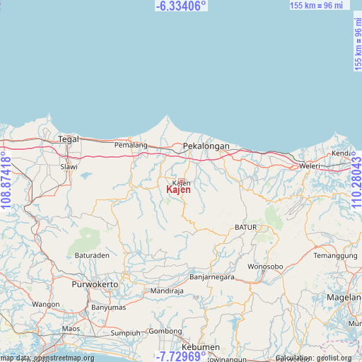
Kajen GPS coordinates[2]
7° 1' 56.64" South, 109° 34' 38.28" East
| Map corner | latitude | longitude |
|---|---|---|
| Upper-left | -6.33406°, | 108.87418° |
| Center: | -7.0324°, | 109.5773° |
| Lower-right: | -7.72969°, | 110.28043° |
| Map W x H: | 155.2×155.2 km | = 96.4×96.4mi |
| max Lat: | 5.88969° ⇑36.2% North |
| Kajen: | -7.0324° |
| min Lat: | ⇓63.8% South -10.934° |
| min Long | Kajen | max Long |
| 95.1345° | 109.5773° | 140.9419° |
| W 34.1%⇐ | ⇒65.9% E |
Elevation
Elevation of Kajen is 36 m = 118 ft, and this is 193.7 m = 635 ft below average elevation for this country.
| Max E: |
3185 m = 10449 ft | 68% |
| Avg. | 229.7 m = 754 ft | |
| Kajen | 36 m = 118 ft | |
Min E: |
-1 m = -3 ft | 32% |
See also: Indonesia elevation on elevation.city.
Geographical zone
Kajen is located in South Torrid zone (between Equator and Tropic of Capricorn). Distance of Equator is 781.9 km =485.8 mi to North.| Distance of | km | miles | from Kajen |
|---|---|---|---|
| Equator | 781.9 | 485.8 | to North |
| Tropic Capricorn | 1824 | 1133.4 | to South |
| Antarctic Circle | 6619.2 | 4113 | to South |
| South Pole | 9225.1 | 5732.2 | to South |


Nearby cities:
15 places around Kajen: (largest is in red/bold)
• Banjarnegara
42.5 km =26.4 mi,  162°
162°
• Batang
21.8 km =13.5 mi,  50°
50°
• Baturaden
49.7 km =30.9 mi,  233°
233°
• Buaran
3.6 km =2.2 mi,  236°
236°
• Comal
14.9 km =9.3 mi,  341°
341°
• Kedungwuni
10.4 km =6.5 mi, 48°
• Lebaksiu
47.8 km =29.7 mi,  267°
267°
• Pekalongan
19.3 km =12 mi,  34°
34°
• Pemalang
26.6 km =16.5 mi,  306°
306°
• Purbalingga
46 km =28.6 mi,  210°
210°
• Randudongkal
28.9 km =18 mi,  255°
255°
• Slawi
48.5 km =30.1 mi,  276°
276°
• Tarub
46.6 km =29 mi, 283°
• Wiradesa
16.3 km =10.1 mi,  16°
16°
• Wonopringgo
7 km =4.3 mi,  38°
38°
Sources, notices
• [Note1] Compared only with cities in Indonesia existing in our database
• [Src1] Map data: © OpenStreetMap contributors (CC-BY-SA)
• [Src2] Other city data from geonames.org with taken over terms of usage.
• [Src3] Geographical zone / Annual Mean Temperature by Robert A. Rohde @ Wikipedia
