Banjarnegara geodata
Banjarnegara (Central Java) is a seat of a second-order administrative division; located in Indonesia in Asia/Jakarta (GMT+7) time zone. In our database, there are 407 cities with bigger population. Compared to other cities in Indonesia, 53.2% of cities are located further ↑North; 65.8% of cities are located further →East and 70.6% of cities have lower elevation than Banjarnegara. Note1


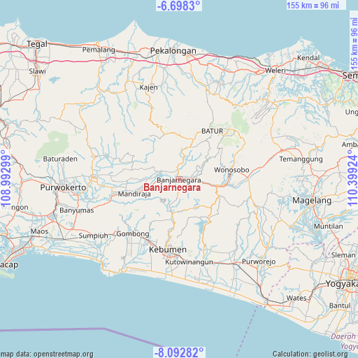
Banjarnegara GPS coordinates[2]
7° 23' 45.996" South, 109° 41' 45.996" East
| Map corner | latitude | longitude |
|---|---|---|
| Upper-left | -6.6983°, | 108.99299° |
| Center: | -7.39611°, | 109.69611° |
| Lower-right: | -8.09282°, | 110.39924° |
| Map W x H: | 155.1×155.1 km | = 96.4×96.4mi |
| max Lat: | 5.88969° ⇑53.2% North |
| Banjarnegara: | -7.39611° |
| min Lat: | ⇓46.8% South -10.934° |
| min Long | Banjarnegara | max Long |
| 95.1345° | 109.69611° | 140.9419° |
| W 34.2%⇐ | ⇒65.8% E |
Elevation
Elevation of Banjarnegara is 300 m = 984 ft, and this is 70.3 m = 231 ft above average elevation for this country.
| Max E: |
3185 m = 10449 ft | 29.4% |
| Banjarnegara | 300 m 984 ft | |
| Avg. | 229.7 m = 754 ft | |
Min E: |
-1 m = -3 ft | 70.6% |
See also: Indonesia elevation on elevation.city.
Geographical zone
Banjarnegara is located in South Torrid zone (between Equator and Tropic of Capricorn). Distance of Equator is 822.4 km =511 mi to North.| Distance of | km | miles | from Banjarnegara |
|---|---|---|---|
| Equator | 822.4 | 511 | to North |
| Tropic Capricorn | 1783.5 | 1108.2 | to South |
| Antarctic Circle | 6578.8 | 4087.9 | to South |
| South Pole | 9184.7 | 5707.1 | to South |


Nearby cities:
15 places around Banjarnegara: (largest is in red/bold)
• Banyumas
46.2 km =28.7 mi,  253°
253°
• Binangun
52 km =32.3 mi, 252°
• Buaran
41.7 km =25.9 mi,  337°
337°
• Gombong
30.9 km =19.2 mi,  220°
220°
• Kajen
42.5 km =26.4 mi, 342°
• Kebumen
30.7 km =19.1 mi,  188°
188°
• Kedungwuni
47.6 km =29.6 mi,  353°
353°
• Kutoarjo
42.9 km =26.7 mi,  146°
146°
• Papringan
50.8 km =31.6 mi,  256°
256°
• Purbalingga
36.6 km =22.7 mi,  271°
271°
• Purwokerto
51 km =31.7 mi, 266°
• Purworejo
49.3 km =30.6 mi,  135°
135°
• Sokaraja
45.5 km =28.3 mi, 261°
• Wonopringgo
46.7 km =29 mi, 349°
• Wonosobo
23.2 km =14.4 mi,  79°
79°
Sources, notices
• [Note1] Compared only with cities in Indonesia existing in our database
• [Src1] Map data: © OpenStreetMap contributors (CC-BY-SA)
• [Src2] Other city data from geonames.org with taken over terms of usage.
• [Src3] Geographical zone / Annual Mean Temperature by Robert A. Rohde @ Wikipedia
