Watergrasshill geodata
Watergrasshill (Munster) is a populated place; located in Ireland in Europe/Dublin (GMT+1) time zone. With population of 1,161 people, there are 320 cities with bigger population in this country. Compared to other cities in Ireland, 92.4% of cities are located further ↑North; 71% of cities are located further →East and 99.4% of cities have lower elevation than Watergrasshill. Note1


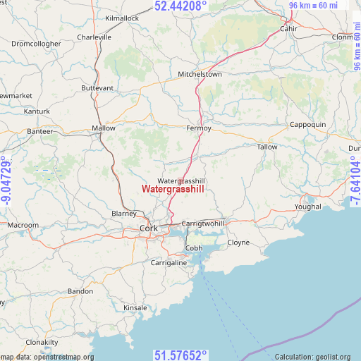
Watergrasshill GPS coordinates[2]
52° 0' 41.004" North, 8° 20' 39.012" West
| Map corner | latitude | longitude |
|---|---|---|
| Upper-left | 52.44208°, | -9.04729° |
| Center: | 52.01139°, | -8.34417° |
| Lower-right: | 51.57652°, | -7.64104° |
| Map W x H: | 96.2×96.2 km | = 59.8×59.8mi |
| max Lat: | 55.25° ⇑92.4% North |
| Watergrasshill: | 52.01139° |
| min Lat: | ⇓7.6% South 51.52487° |
| min Long | Watergrasshill | max Long |
| -10.26889° | -8.34417° | -6.04944° |
| W 29%⇐ | ⇒71% E |
Elevation
Elevation of Watergrasshill is 182 m = 597 ft, and this is 127.5 m = 418 ft above average elevation for this country.
| Max E: |
262 m = 860 ft | 0.59999999999999% |
| Watergrasshill | 182 m 597 ft | |
| Avg. | 54.5 m = 179 ft | |
Min E: |
0 m = 0 ft | 99.4% |
See also: Ireland elevation on elevation.city.
Geographical zone
Watergrasshill is located in North temperate zone (between Tropic of Cancer and the Arctic Circle). Distance of this North polar circle is 1618 km =1005.4 mi to North.| Distance of | km | miles | from Watergrasshill |
|---|---|---|---|
| North Pole | 4223.9 | 2624.6 | to North |
| Arctic Circle | 1618 | 1005.4 | to North |
| Tropic Cancer | 3177.2 | 1974.2 | to South |
| Equator | 5783.1 | 3593.5 | to South |


Nearby cities:
15 places around Watergrasshill: (largest is in red/bold)
• Aghada
21.2 km =13.2 mi,  154°
154°
• Blarney
17.5 km =10.9 mi,  240°
240°
• Carrigtwohill
12.7 km =7.9 mi, 154°
• Cobh
18.2 km =11.3 mi,  169°
169°
• Cork
15.3 km =9.5 mi,  214°
214°
• Courtbrack
21.3 km =13.2 mi,  256°
256°
• Fermoy
14.6 km =9.1 mi,  18°
18°
• Glanworth
19.5 km =12.1 mi,  357°
357°
• Grenagh
18.1 km =11.2 mi,  271°
271°
• Kilworth
19.6 km =12.2 mi, 20°
• Midleton
15.5 km =9.6 mi,  133°
133°
• Passage West
15.3 km =9.5 mi,  180°
180°
• Rathcormac
8.4 km =5.2 mi,  30°
30°
• Tower
20.4 km =12.7 mi, 242°
• Whitechurch
12.1 km =7.5 mi,  253°
253°
Sources, notices
• [Note1] Compared only with cities in Ireland existing in our database
• [Src1] Map data: © OpenStreetMap contributors (CC-BY-SA)
• [Src2] Other city data from geonames.org with taken over terms of usage.
• [Src3] Geographical zone / Annual Mean Temperature by Robert A. Rohde @ Wikipedia
