Edenderry geodata
Edenderry (Leinster) is a populated place; located in Ireland in Europe/Dublin (GMT+1) time zone. With population of 4,890 people, there are 139 cities with bigger population in this country. Compared to other cities in Ireland, 59.6% of cities are located further ↓South; 57.7% of cities are located further ←West and 85.8% of cities have lower elevation than Edenderry. Note1


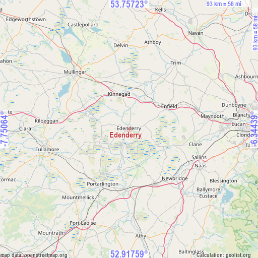
Edenderry GPS coordinates[2]
53° 20' 22.128" North, 7° 2' 51.072" West
| Map corner | latitude | longitude |
|---|---|---|
| Upper-left | 53.75723°, | -7.75064° |
| Center: | 53.33948°, | -7.04752° |
| Lower-right: | 52.91759°, | -6.34439° |
| Map W x H: | 93.4×93.4 km | = 58×58mi |
| max Lat: | 55.25° ⇑40.4% North |
| Edenderry: | 53.33948° |
| min Lat: | ⇓59.6% South 51.52487° |
| min Long | Edenderry | max Long |
| -10.26889° | -7.04752° | -6.04944° |
| W 57.7%⇐ | ⇒42.3% E |
Elevation
Elevation of Edenderry is 97 m = 318 ft, and this is 42.5 m = 139 ft above average elevation for this country.
| Max E: |
262 m = 860 ft | 14.2% |
| Edenderry | 97 m 318 ft | |
| Avg. | 54.5 m = 179 ft | |
Min E: |
0 m = 0 ft | 85.8% |
See also: Ireland elevation on elevation.city.
Geographical zone
Edenderry is located in North temperate zone (between Tropic of Cancer and the Arctic Circle). Distance of this North polar circle is 1470.4 km =913.7 mi to North.| Distance of | km | miles | from Edenderry |
|---|---|---|---|
| North Pole | 4076.3 | 2532.9 | to North |
| Arctic Circle | 1470.4 | 913.7 | to North |
| Tropic Cancer | 3324.9 | 2066 | to South |
| Equator | 5930.8 | 3685.2 | to South |


Nearby cities:
15 places around Edenderry: (largest is in red/bold)
• Allenwood Cross Roads
13.8 km =8.6 mi,  116°
116°
• Blackwood
16.1 km =10 mi,  108°
108°
• Daingean
16.8 km =10.4 mi,  253°
253°
• Derrinturn
7.1 km =4.4 mi,  88°
88°
• Enfield
16.5 km =10.3 mi,  59°
59°
• Johnstown Bridge
14.4 km =8.9 mi, 60°
• Kilmeage
16.8 km =10.4 mi,  125°
125°
• Kinnegad
13 km =8.1 mi,  344°
344°
• Longwood
15.2 km =9.4 mi,  33°
33°
• Prosperous
20.3 km =12.6 mi, 105°
• Rathangan
13.6 km =8.5 mi,  165°
165°
• Rathwire
19.6 km =12.2 mi, 342°
• Rhode
10.3 km =6.4 mi,  277°
277°
• Robertstown
16.9 km =10.5 mi, 115°
• Rochfortbridge
18.5 km =11.5 mi,  296°
296°
Sources, notices
• [Note1] Compared only with cities in Ireland existing in our database
• [Src1] Map data: © OpenStreetMap contributors (CC-BY-SA)
• [Src2] Other city data from geonames.org with taken over terms of usage.
• [Src3] Geographical zone / Annual Mean Temperature by Robert A. Rohde @ Wikipedia
