Daingean geodata
Daingean (Leinster) is a populated place; located in Ireland in Europe/Dublin (GMT+1) time zone. With population of 1,037 people, there are 343 cities with bigger population in this country. Compared to other cities in Ireland, 55.2% of cities are located further ↓South; 52.8% of cities are located further ←West and 74.8% of cities have lower elevation than Daingean. Note1


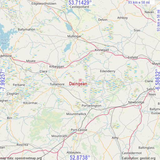
Daingean GPS coordinates[2]
53° 17' 45.996" North, 7° 17' 21.984" West
| Map corner | latitude | longitude |
|---|---|---|
| Upper-left | 53.71429°, | -7.99257° |
| Center: | 53.29611°, | -7.28944° |
| Lower-right: | 52.8738°, | -6.58632° |
| Map W x H: | 93.5×93.5 km | = 58.1×58.1mi |
| max Lat: | 55.25° ⇑44.8% North |
| Daingean: | 53.29611° |
| min Lat: | ⇓55.2% South 51.52487° |
| min Long | Daingean | max Long |
| -10.26889° | -7.28944° | -6.04944° |
| W 52.8%⇐ | ⇒47.2% E |
Elevation
Elevation of Daingean is 79 m = 259 ft, and this is 24.5 m = 80 ft above average elevation for this country.
| Max E: |
262 m = 860 ft | 25.2% |
| Daingean | 79 m 259 ft | |
| Avg. | 54.5 m = 179 ft | |
Min E: |
0 m = 0 ft | 74.8% |
See also: Ireland elevation on elevation.city.
Geographical zone
Daingean is located in North temperate zone (between Tropic of Cancer and the Arctic Circle). Distance of this North polar circle is 1475.2 km =916.6 mi to North.| Distance of | km | miles | from Daingean |
|---|---|---|---|
| North Pole | 4081.1 | 2535.9 | to North |
| Arctic Circle | 1475.2 | 916.6 | to North |
| Tropic Cancer | 3320.1 | 2063 | to South |
| Equator | 5926 | 3682.2 | to South |


Nearby cities:
15 places around Daingean: (largest is in red/bold)
• Clara
22.2 km =13.8 mi,  283°
283°
• Clonaslee
22.8 km =14.2 mi,  223°
223°
• Derrinturn
23.7 km =14.7 mi,  77°
77°
• Edenderry
16.8 km =10.4 mi,  73°
73°
• Kilbeggan
16.4 km =10.2 mi,  299°
299°
• Killenard
20.4 km =12.7 mi,  152°
152°
• Kinnegad
21.4 km =13.3 mi,  35°
35°
• Monasterevin
22.8 km =14.2 mi,  139°
139°
• Mountmellick
20.4 km =12.7 mi,  185°
185°
• Portarlington
16.3 km =10.1 mi,  156°
156°
• Rathangan
21.3 km =13.2 mi,  112°
112°
• Rhode
8.5 km =5.3 mi, 43°
• Rochfortbridge
13.1 km =8.1 mi,  358°
358°
• Tullamore
13.5 km =8.4 mi,  259°
259°
• Tyrrellspass
11.7 km =7.3 mi,  331°
331°
Sources, notices
• [Note1] Compared only with cities in Ireland existing in our database
• [Src1] Map data: © OpenStreetMap contributors (CC-BY-SA)
• [Src2] Other city data from geonames.org with taken over terms of usage.
• [Src3] Geographical zone / Annual Mean Temperature by Robert A. Rohde @ Wikipedia
