Kilrane geodata
Kilrane (Leinster) is a populated place; located in Ireland in Europe/Dublin (GMT+1) time zone. With population of 594 people, there are 481 cities with bigger population in this country. Compared to other cities in Ireland, 87.5% of cities are located further ↑North; 81% of cities are located further ←West and 78.4% of cities have higher elevation than Kilrane. Note1


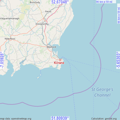
Kilrane GPS coordinates[2]
52° 14' 31.272" North, 6° 21' 22.14" West
| Map corner | latitude | longitude |
|---|---|---|
| Upper-left | 52.67048°, | -7.05928° |
| Center: | 52.24202°, | -6.35615° |
| Lower-right: | 51.80939°, | -5.65303° |
| Map W x H: | 95.7×95.7 km | = 59.5×59.5mi |
| max Lat: | 55.25° ⇑87.5% North |
| Kilrane: | 52.24202° |
| min Lat: | ⇓12.5% South 51.52487° |
| min Long | Kilrane | max Long |
| -10.26889° | -6.35615° | -6.04944° |
| W 81%⇐ | ⇒19% E |
Elevation
Elevation of Kilrane is 18 m = 59 ft, and this is 36.5 m = 120 ft below average elevation for this country.
| Max E: |
262 m = 860 ft | 78.4% |
| Avg. | 54.5 m = 179 ft | |
| Kilrane | 18 m = 59 ft | |
Min E: |
0 m = 0 ft | 21.6% |
See also: Ireland elevation on elevation.city.
Geographical zone
Kilrane is located in North temperate zone (between Tropic of Cancer and the Arctic Circle). Distance of this North polar circle is 1592.4 km =989.5 mi to North.| Distance of | km | miles | from Kilrane |
|---|---|---|---|
| North Pole | 4198.3 | 2608.7 | to North |
| Arctic Circle | 1592.4 | 989.5 | to North |
| Tropic Cancer | 3202.8 | 1990.1 | to South |
| Equator | 5808.8 | 3609.4 | to South |


Nearby cities:
15 places around Kilrane: (largest is in red/bold)
• Ballinroad
30.9 km =19.2 mi,  353°
353°
• Ballycanew
41 km =25.5 mi,  5°
5°
• Ballygerry
0.8 km =0.5 mi, 353°
• Castlebridge
17.3 km =10.7 mi,  338°
338°
• Courtown
45.5 km =28.3 mi, 10°
• Dunmore East
44.9 km =27.9 mi,  256°
256°
• Enniscorthy
31.9 km =19.8 mi,  334°
334°
• Ferns
39.7 km =24.7 mi, 345°
• Ford
30.5 km =19 mi, 9°
• Loch Garman
12.3 km =7.6 mi, 326°
• New Ross
43 km =26.7 mi,  293°
293°
• Passage East
42.1 km =26.2 mi,  268°
268°
• Piercetown
10.2 km =6.3 mi,  297°
297°
• Rosslare
4.2 km =2.6 mi, 332°
• Taghmon
21.7 km =13.5 mi, 294°
Sources, notices
• [Note1] Compared only with cities in Ireland existing in our database
• [Src1] Map data: © OpenStreetMap contributors (CC-BY-SA)
• [Src2] Other city data from geonames.org with taken over terms of usage.
• [Src3] Geographical zone / Annual Mean Temperature by Robert A. Rohde @ Wikipedia
