Ballygerry geodata
Ballygerry (Leinster) is a section of populated place; located in Ireland in Europe/Dublin (GMT+1) time zone. With population of 1,123 people, there are 327 cities with bigger population in this country. Compared to other cities in Ireland, 87.3% of cities are located further ↑North; 80.8% of cities are located further ←West and 92.6% of cities have higher elevation than Ballygerry. Note1


Ballygerry GPS coordinates[2]
52° 14' 57.012" North, 6° 21' 26.604" West
| Map corner | latitude | longitude |
|---|---|---|
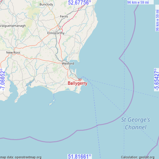
| Upper-left | 52.67756°, | -7.06052° |
| Center: | 52.24917°, | -6.35739° |
| Lower-right: | 51.81661°, | -5.65427° |
| Map W x H: | 95.7×95.7 km | = 59.5×59.5mi |
| max Lat: | 55.25° ⇑87.3% North |
| Ballygerry: | 52.24917° |
| min Lat: | ⇓12.7% South 51.52487° |
| min Long | Ballygerry | max Long |
| -10.26889° | -6.35739° | -6.04944° |
| W 80.8%⇐ | ⇒19.2% E |
Elevation
Elevation of Ballygerry is 8 m = 26 ft, and this is 46.5 m = 153 ft below average elevation for this country.
| Max E: |
262 m = 860 ft | 92.6% |
| Avg. | 54.5 m = 179 ft | |
| Ballygerry | 8 m = 26 ft | |
Min E: |
0 m = 0 ft | 7.4% |
See also: Ireland elevation on elevation.city.
Geographical zone
Ballygerry is located in North temperate zone (between Tropic of Cancer and the Arctic Circle). Distance of this North polar circle is 1591.6 km =989 mi to North.| Distance of | km | miles | from Ballygerry |
|---|---|---|---|
| North Pole | 4197.5 | 2608.2 | to North |
| Arctic Circle | 1591.6 | 989 | to North |
| Tropic Cancer | 3203.6 | 1990.6 | to South |
| Equator | 5809.6 | 3609.9 | to South |


Nearby cities:
15 places around Ballygerry: (largest is in red/bold)
• Ballinroad
30.1 km =18.7 mi,  353°
353°
• Ballycanew
40.2 km =25 mi,  5°
5°
• Castlebridge
16.5 km =10.3 mi,  337°
337°
• Courtown
44.8 km =27.8 mi, 11°
• Dunmore East
45 km =28 mi,  255°
255°
• Enniscorthy
31.1 km =19.3 mi,  334°
334°
• Ferns
38.9 km =24.2 mi, 345°
• Ford
29.7 km =18.5 mi, 10°
• Kilrane
0.8 km =0.5 mi,  173°
173°
• Loch Garman
11.6 km =7.2 mi,  324°
324°
• New Ross
42.6 km =26.5 mi,  292°
292°
• Passage East
42 km =26.1 mi,  267°
267°
• Piercetown
9.8 km =6.1 mi, 293°
• Rosslare
3.5 km =2.2 mi, 328°
• Taghmon
21.3 km =13.2 mi, 292°
Sources, notices
• [Note1] Compared only with cities in Ireland existing in our database
• [Src1] Map data: © OpenStreetMap contributors (CC-BY-SA)
• [Src2] Other city data from geonames.org with taken over terms of usage.
• [Src3] Geographical zone / Annual Mean Temperature by Robert A. Rohde @ Wikipedia
