Kilmacthomas geodata
Kilmacthomas (Munster) is a populated place; located in Ireland in Europe/Dublin (GMT+1) time zone. With population of 871 people, there are 374 cities with bigger population in this country. Compared to other cities in Ireland, 88.6% of cities are located further ↑North; 50.9% of cities are located further →East and 52.9% of cities have higher elevation than Kilmacthomas. Note1


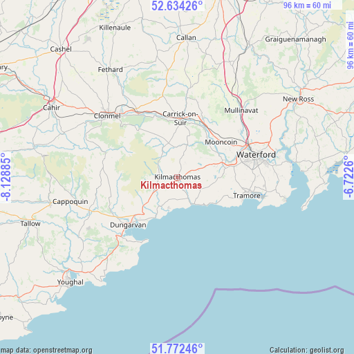
Kilmacthomas GPS coordinates[2]
52° 12' 19.62" North, 7° 25' 32.628" West
| Map corner | latitude | longitude |
|---|---|---|
| Upper-left | 52.63426°, | -8.12885° |
| Center: | 52.20545°, | -7.42573° |
| Lower-right: | 51.77246°, | -6.7226° |
| Map W x H: | 95.8×95.8 km | = 59.5×59.5mi |
| max Lat: | 55.25° ⇑88.6% North |
| Kilmacthomas: | 52.20545° |
| min Lat: | ⇓11.4% South 51.52487° |
| min Long | Kilmacthomas | max Long |
| -10.26889° | -7.42573° | -6.04944° |
| W 49.1%⇐ | ⇒50.9% E |
Elevation
Elevation of Kilmacthomas is 47 m = 154 ft, and this is 7.5 m = 25 ft below average elevation for this country.
| Max E: |
262 m = 860 ft | 52.9% |
| Avg. | 54.5 m = 179 ft | |
| Kilmacthomas | 47 m = 154 ft | |
Min E: |
0 m = 0 ft | 47.1% |
See also: Ireland elevation on elevation.city.
Geographical zone
Kilmacthomas is located in North temperate zone (between Tropic of Cancer and the Arctic Circle). Distance of this North polar circle is 1596.5 km =992 mi to North.| Distance of | km | miles | from Kilmacthomas |
|---|---|---|---|
| North Pole | 4202.4 | 2611.2 | to North |
| Arctic Circle | 1596.5 | 992 | to North |
| Tropic Cancer | 3198.8 | 1987.6 | to South |
| Equator | 5804.7 | 3606.9 | to South |


Nearby cities:
15 places around Kilmacthomas: (largest is in red/bold)
• Ardfinnan
32.8 km =20.4 mi,  291°
291°
• Ballyclerahan
32.1 km =19.9 mi,  315°
315°
• Cappoquin
30 km =18.6 mi,  257°
257°
• Carrick-on-Suir
16 km =9.9 mi,  3°
3°
• Cluain Meala
25.2 km =15.7 mi,  311°
311°
• Dungarvan
18.9 km =11.7 mi,  226°
226°
• Dunmore East
29.7 km =18.5 mi,  101°
101°
• Kilmacow
21 km =13 mi,  53°
53°
• Kilsheelan
20 km =12.4 mi,  329°
329°
• Mooncoin
15.3 km =9.5 mi, 52°
• Passage East
30.9 km =19.2 mi,  84°
84°
• Piltown
17.4 km =10.8 mi,  19°
19°
• Portlaw
11.7 km =7.3 mi,  37°
37°
• Trá Mhór
19.2 km =11.9 mi, 104°
• Waterford
22.2 km =13.8 mi,  74°
74°
Sources, notices
• [Note1] Compared only with cities in Ireland existing in our database
• [Src1] Map data: © OpenStreetMap contributors (CC-BY-SA)
• [Src2] Other city data from geonames.org with taken over terms of usage.
• [Src3] Geographical zone / Annual Mean Temperature by Robert A. Rohde @ Wikipedia
