Waterford geodata
Waterford (Munster) is a seat of a second-order administrative division; located in Ireland in Europe/Dublin (GMT+1) time zone. With population of 47,904 people, there are 6 cities with bigger population in this country. Compared to other cities in Ireland, 87.1% of cities are located further ↑North; 56.4% of cities are located further ←West and 89.6% of cities have higher elevation than Waterford. Note1


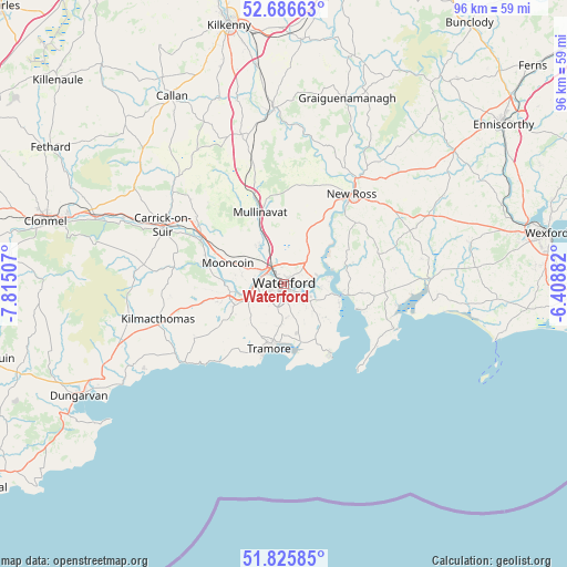
Waterford GPS coordinates[2]
52° 15' 29.988" North, 7° 6' 42.984" West
| Map corner | latitude | longitude |
|---|---|---|
| Upper-left | 52.68663°, | -7.81507° |
| Center: | 52.25833°, | -7.11194° |
| Lower-right: | 51.82585°, | -6.40882° |
| Map W x H: | 95.7×95.7 km | = 59.5×59.5mi |
| max Lat: | 55.25° ⇑87.1% North |
| Waterford: | 52.25833° |
| min Lat: | ⇓12.9% South 51.52487° |
| min Long | Waterford | max Long |
| -10.26889° | -7.11194° | -6.04944° |
| W 56.4%⇐ | ⇒43.6% E |
Elevation
Elevation of Waterford is 10 m = 33 ft, and this is 44.5 m = 146 ft below average elevation for this country.
| Max E: |
262 m = 860 ft | 89.6% |
| Avg. | 54.5 m = 179 ft | |
| Waterford | 10 m = 33 ft | |
Min E: |
0 m = 0 ft | 10.4% |
See also: Waterford elevation on elevation.city.
Geographical zone
Waterford is located in North temperate zone (between Tropic of Cancer and the Arctic Circle). Distance of this North polar circle is 1590.6 km =988.4 mi to North.| Distance of | km | miles | from Waterford |
|---|---|---|---|
| North Pole | 4196.5 | 2607.6 | to North |
| Arctic Circle | 1590.6 | 988.4 | to North |
| Tropic Cancer | 3204.7 | 1991.3 | to South |
| Equator | 5810.6 | 3610.5 | to South |


Nearby cities:
15 places around Waterford: (largest is in red/bold)
• Callan
37.1 km =23.1 mi,  329°
329°
• Carrick-on-Suir
22.8 km =14.2 mi,  296°
296°
• Dunmore East
14.2 km =8.8 mi,  147°
147°
• Graiguenamanagh
33.1 km =20.6 mi,  18°
18°
• Kilmacow
7.9 km =4.9 mi, 325°
• Kilmacthomas
22.2 km =13.8 mi,  254°
254°
• Kilsheelan
33.6 km =20.9 mi,  289°
289°
• Mooncoin
9.9 km =6.2 mi, 290°
• New Ross
19.5 km =12.1 mi,  37°
37°
• Passage East
9.9 km =6.2 mi,  108°
108°
• Piltown
18.8 km =11.7 mi, 304°
• Portlaw
14.6 km =9.1 mi,  283°
283°
• Taghmon
32.4 km =20.1 mi,  77°
77°
• Thomastown
29.9 km =18.6 mi,  356°
356°
• Trá Mhór
11 km =6.8 mi,  194°
194°
Sources, notices
• [Note1] Compared only with cities in Ireland existing in our database
• [Src1] Map data: © OpenStreetMap contributors (CC-BY-SA)
• [Src2] Other city data from geonames.org with taken over terms of usage.
• [Src3] Geographical zone / Annual Mean Temperature by Robert A. Rohde @ Wikipedia
