Glin geodata
Glin (Munster) is a populated place; located in Ireland in Europe/Dublin (GMT+1) time zone. With population of 577 people, there are 490 cities with bigger population in this country. Compared to other cities in Ireland, 77.4% of cities are located further ↑North; 93.2% of cities are located further →East and 82.9% of cities have higher elevation than Glin. Note1


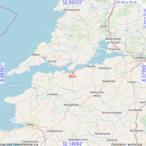
Glin GPS coordinates[2]
52° 34' 13.008" North, 9° 16' 58.008" West
| Map corner | latitude | longitude |
|---|---|---|
| Upper-left | 52.99555°, | -9.98591° |
| Center: | 52.57028°, | -9.28278° |
| Lower-right: | 52.14084°, | -8.57966° |
| Map W x H: | 95×95 km | = 59×59mi |
| max Lat: | 55.25° ⇑77.4% North |
| Glin: | 52.57028° |
| min Lat: | ⇓22.6% South 51.52487° |
| min Long | Glin | max Long |
| -10.26889° | -9.28278° | -6.04944° |
| W 6.8%⇐ | ⇒93.2% E |
Elevation
Elevation of Glin is 15 m = 49 ft, and this is 39.5 m = 130 ft below average elevation for this country.
| Max E: |
262 m = 860 ft | 82.9% |
| Avg. | 54.5 m = 179 ft | |
| Glin | 15 m = 49 ft | |
Min E: |
0 m = 0 ft | 17.1% |
See also: Ireland elevation on elevation.city.
Geographical zone
Glin is located in North temperate zone (between Tropic of Cancer and the Arctic Circle). Distance of this North polar circle is 1555.9 km =966.8 mi to North.| Distance of | km | miles | from Glin |
|---|---|---|---|
| North Pole | 4161.8 | 2586 | to North |
| Arctic Circle | 1555.9 | 966.8 | to North |
| Tropic Cancer | 3239.3 | 2012.8 | to South |
| Equator | 5845.3 | 3632.1 | to South |


Nearby cities:
15 places around Glin: (largest is in red/bold)
• Abbeyfeale
21 km =13 mi,  183°
183°
• Askeaton
21 km =13 mi,  81°
81°
• Ballingarry
30.3 km =18.8 mi,  110°
110°
• Ballybunnion
27.1 km =16.8 mi,  255°
255°
• Ballyduff
28.9 km =18 mi,  242°
242°
• Foynes
12.5 km =7.8 mi,  68°
68°
• Kilrush
15.6 km =9.7 mi,  299°
299°
• Listowel
19.4 km =12.1 mi,  224°
224°
• Lixnaw
29.1 km =18.1 mi,  231°
231°
• Miltown Malbay
32.6 km =20.3 mi,  346°
346°
• Newcastle West
20.2 km =12.6 mi,  131°
131°
• Pallaskenry
29.1 km =18.1 mi, 73°
• Rathkeale
23.9 km =14.9 mi,  102°
102°
• Shannon
31.9 km =19.8 mi,  62°
62°
• Tarbert
6.3 km =3.9 mi,  272°
272°
Sources, notices
• [Note1] Compared only with cities in Ireland existing in our database
• [Src1] Map data: © OpenStreetMap contributors (CC-BY-SA)
• [Src2] Other city data from geonames.org with taken over terms of usage.
• [Src3] Geographical zone / Annual Mean Temperature by Robert A. Rohde @ Wikipedia
