Shahdara geodata
Shahdara (Delhi) is a seat of a second-order administrative division; located in India in Asia/Kolkata (GMT+5.5) time zone. In our database, there are 3475 cities with bigger population. Compared to other cities in India, 87.2% of cities are located further ↓South; 61.5% of cities are located further →East and 54.2% of cities have lower elevation than Shahdara. Note1


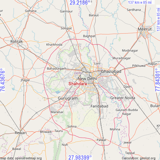
Shahdara GPS coordinates[2]
28° 36' 11.196" North, 77° 8' 23.568" East
| Map corner | latitude | longitude |
|---|---|---|
| Upper-left | 29.2186°, | 76.43676° |
| Center: | 28.60311°, | 77.13988° |
| Lower-right: | 27.98399°, | 77.84301° |
| Map W x H: | 137.3×137.3 km | = 85.3×85.3mi |
| max Lat: | 34.9274° ⇑12.8% North |
| Shahdara: | 28.60311° |
| min Lat: | ⇓87.2% South 8.09008° |
| min Long | Shahdara | max Long |
| 68.82655° | 77.13988° | 96.81° |
| W 38.5%⇐ | ⇒61.5% E |
Elevation
Elevation of Shahdara is 223 m = 732 ft, and this is 72.6 m = 238 ft below average elevation for this country.
| Max E: |
3681 m = 12077 ft | 45.8% |
| Avg. | 295.6 m = 970 ft | |
| Shahdara | 223 m = 732 ft | |
Min E: |
1 m = 3 ft | 54.2% |
See also: India elevation on elevation.city.
Geographical zone
Shahdara is located in North temperate zone (between Tropic of Cancer and the Arctic Circle). Distance of this Northern Tropic circle is 574.4 km =356.9 mi to South.| Distance of | km | miles | from Shahdara |
|---|---|---|---|
| North Pole | 6826.7 | 4241.9 | to North |
| Arctic Circle | 4220.8 | 2622.7 | to North |
| Tropic Cancer | 574.4 | 356.9 | to South |
| Equator | 3180.4 | 1976.2 | to South |


Nearby cities:
15 places around Shahdara: (largest is in red/bold)
• Alīpur
21.7 km =13.5 mi,  358°
358°
• Bahādurgarh
22.3 km =13.9 mi,  296°
296°
• Defence Colony
9.7 km =6 mi,  111°
111°
• Delhi
10.5 km =6.5 mi,  58°
58°
• Deoli
14.3 km =8.9 mi,  141°
141°
• Gurgaon
19.4 km =12.1 mi,  214°
214°
• Karol Bāgh
7.3 km =4.5 mi,  42°
42°
• Loni
22.1 km =13.7 mi, 41°
• Najafgarh
15.6 km =9.7 mi,  272°
272°
• New Delhi
9 km =5.6 mi,  66°
66°
• Noida
18.7 km =11.6 mi,  97°
97°
• Nāngloi Jāt
11 km =6.8 mi,  320°
320°
• Pitampura
9.7 km =6 mi, 355°
• Rohini
17.1 km =10.6 mi,  335°
335°
• Sector
18.5 km =11.5 mi, 101°
Sources, notices
• [Note1] Compared only with cities in India existing in our database
• [Src1] Map data: © OpenStreetMap contributors (CC-BY-SA)
• [Src2] Other city data from geonames.org with taken over terms of usage.
• [Src3] Geographical zone / Annual Mean Temperature by Robert A. Rohde @ Wikipedia
