Walajapet geodata
Walajapet (Tamil Nadu) is a populated place; located in India in Asia/Kolkata (GMT+5.5) time zone. With population of 30,256 people, there are 1432 cities with bigger population in this country. Compared to other cities in India, 86.9% of cities are located further ↑North; 62.5% of cities are located further ←West and 55.3% of cities have higher elevation than Walajapet. Note1


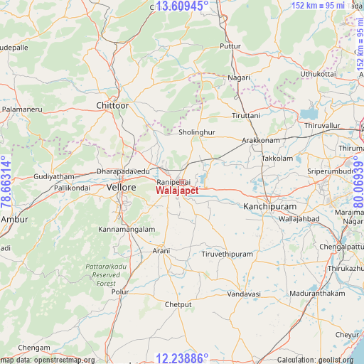
Walajapet GPS coordinates[2]
12° 55' 30.36" North, 79° 21' 58.536" East
| Map corner | latitude | longitude |
|---|---|---|
| Upper-left | 13.60945°, | 78.66314° |
| Center: | 12.9251°, | 79.36626° |
| Lower-right: | 12.23886°, | 80.06939° |
| Map W x H: | 152.4×152.4 km | = 94.7×94.7mi |
| max Lat: | 34.9274° ⇑86.9% North |
| Walajapet: | 12.9251° |
| min Lat: | ⇓13.1% South 8.09008° |
| min Long | Walajapet | max Long |
| 68.82655° | 79.36626° | 96.81° |
| W 62.5%⇐ | ⇒37.5% E |
Elevation
Elevation of Walajapet is 173 m = 568 ft, and this is 122.6 m = 402 ft below average elevation for this country.
| Max E: |
3681 m = 12077 ft | 55.3% |
| Avg. | 295.6 m = 970 ft | |
| Walajapet | 173 m = 568 ft | |
Min E: |
1 m = 3 ft | 44.7% |
See also: India elevation on elevation.city.
Geographical zone
Walajapet is located in North Torrid zone (between Equator and Tropic of Cancer). Distance of this Northern Tropic circle is 1168.8 km =726.3 mi to North.| Distance of | km | miles | from Walajapet |
|---|---|---|---|
| North Pole | 8569.9 | 5325.1 | to North |
| Arctic Circle | 5964 | 3705.9 | to North |
| Tropic Cancer | 1168.8 | 726.3 | to North |
| Equator | 1437.1 | 893 | to South |


Nearby cities:
15 places around Walajapet: (largest is in red/bold)
• Arakkonam
37.4 km =23.2 mi,  61°
61°
• Arcot
5.6 km =3.5 mi,  247°
247°
• Arni
29.9 km =18.6 mi,  197°
197°
• Cheyyar
35.1 km =21.8 mi,  146°
146°
• Chittoor
43.2 km =26.8 mi,  317°
317°
• Dūsi
37.7 km =23.4 mi,  116°
116°
• Kalavai
18.2 km =11.3 mi,  161°
161°
• Kanchipuram
37.5 km =23.3 mi,  105°
105°
• Kātpādi
24.4 km =15.2 mi,  281°
281°
• Peranamallūr
40.1 km =24.9 mi,  169°
169°
• Pudūr
25.5 km =15.8 mi,  288°
288°
• Rāmāpuram
27.8 km =17.3 mi,  314°
314°
• Sholinghur
22.2 km =13.8 mi,  15°
15°
• Thiruthani
38.9 km =24.2 mi,  44°
44°
• Vellore
25.3 km =15.7 mi,  268°
268°
Sources, notices
• [Note1] Compared only with cities in India existing in our database
• [Src1] Map data: © OpenStreetMap contributors (CC-BY-SA)
• [Src2] Other city data from geonames.org with taken over terms of usage.
• [Src3] Geographical zone / Annual Mean Temperature by Robert A. Rohde @ Wikipedia
