Sāgar geodata
Sāgar (Karnataka) is a populated place; located in India in Asia/Kolkata (GMT+5.5) time zone. With population of 53,150 people, there are 839 cities with bigger population in this country. Compared to other cities in India, 83% of cities are located further ↑North; 82.5% of cities are located further →East and 88% of cities have lower elevation than Sāgar. Note1


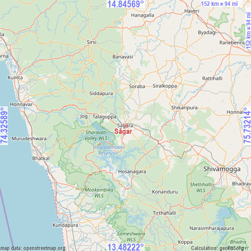
Sāgar GPS coordinates[2]
14° 9' 53.928" North, 75° 1' 44.436" East
| Map corner | latitude | longitude |
|---|---|---|
| Upper-left | 14.84569°, | 74.32589° |
| Center: | 14.16498°, | 75.02901° |
| Lower-right: | 13.48222°, | 75.73214° |
| Map W x H: | 151.6×151.6 km | = 94.2×94.2mi |
| max Lat: | 34.9274° ⇑83% North |
| Sāgar: | 14.16498° |
| min Lat: | ⇓17% South 8.09008° |
| min Long | Sāgar | max Long |
| 68.82655° | 75.02901° | 96.81° |
| W 17.5%⇐ | ⇒82.5% E |
Elevation
Elevation of Sāgar is 592 m = 1942 ft, and this is 296.4 m = 972 ft above average elevation for this country.
| Max E: |
3681 m = 12077 ft | 12% |
| Sāgar | 592 m 1942 ft | |
| Avg. | 295.6 m = 970 ft | |
Min E: |
1 m = 3 ft | 88% |
See also: Sāgar elevation on elevation.city.
Geographical zone
Sāgar is located in North Torrid zone (between Equator and Tropic of Cancer). Distance of this Northern Tropic circle is 1030.9 km =640.6 mi to North.| Distance of | km | miles | from Sāgar |
|---|---|---|---|
| North Pole | 8432.1 | 5239.5 | to North |
| Arctic Circle | 5826.2 | 3620.2 | to North |
| Tropic Cancer | 1030.9 | 640.6 | to North |
| Equator | 1575 | 978.7 | to South |


Nearby cities:
15 places around Sāgar: (largest is in red/bold)
• Beltangadi
35.5 km =22.1 mi,  124°
124°
• Bhatkal
54.9 km =34.1 mi,  248°
248°
• Byndoor
54.1 km =33.6 mi,  232°
232°
• Hirekerūr
51 km =31.7 mi,  50°
50°
• Hosanagara
28.2 km =17.5 mi,  172°
172°
• Hosangadi
52.6 km =32.7 mi,  188°
188°
• Kumsi
41.8 km =26 mi,  107°
107°
• Murudeshwara
59.2 km =36.8 mi,  262°
262°
• Nyāmti
59 km =36.7 mi,  91°
91°
• Shikārpur
37.2 km =23.1 mi,  71°
71°
• Shimoga
63.7 km =39.6 mi, 114°
• Siddāpur
24.6 km =15.3 mi,  323°
323°
• Sirsi
54.8 km =34.1 mi,  337°
337°
• Sorab
25 km =15.5 mi,  15°
15°
• Tīrthahalli
57.9 km =36 mi,  156°
156°
Sources, notices
• [Note1] Compared only with cities in India existing in our database
• [Src1] Map data: © OpenStreetMap contributors (CC-BY-SA)
• [Src2] Other city data from geonames.org with taken over terms of usage.
• [Src3] Geographical zone / Annual Mean Temperature by Robert A. Rohde @ Wikipedia
