Puri geodata
Puri (Odisha) is a populated place; located in India in Asia/Kolkata (GMT+5.5) time zone. With population of 170,841 people, there are 251 cities with bigger population in this country. Compared to other cities in India, 66% of cities are located further ↑North; 86.3% of cities are located further ←West and 91.1% of cities have higher elevation than Puri. Note1


Puri GPS coordinates[2]
19° 47' 53.7" North, 85° 49' 29.784" East
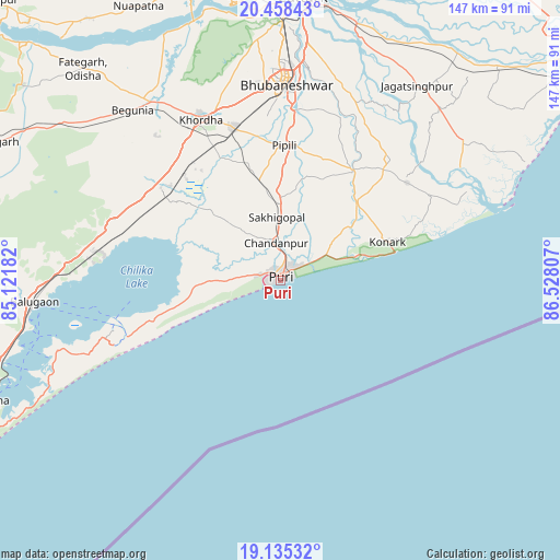
| Map corner | latitude | longitude |
|---|---|---|
| Upper-left | 20.45843°, | 85.12182° |
| Center: | 19.79825°, | 85.82494° |
| Lower-right: | 19.13532°, | 86.52807° |
| Map W x H: | 147.1×147.1 km | = 91.4×91.4mi |
| max Lat: | 34.9274° ⇑66% North |
| Puri: | 19.79825° |
| min Lat: | ⇓34% South 8.09008° |
| min Long | Puri | max Long |
| 68.82655° | 85.82494° | 96.81° |
| W 86.3%⇐ | ⇒13.7% E |
Elevation
Elevation of Puri is 16 m = 52 ft, and this is 279.6 m = 917 ft below average elevation for this country.
| Max E: |
3681 m = 12077 ft | 91.1% |
| Avg. | 295.6 m = 970 ft | |
| Puri | 16 m = 52 ft | |
Min E: |
1 m = 3 ft | 8.9% |
See also: Puri elevation on elevation.city.
Geographical zone
Puri is located in North Torrid zone (between Equator and Tropic of Cancer). Distance of this Northern Tropic circle is 404.6 km =251.4 mi to North.| Distance of | km | miles | from Puri |
|---|---|---|---|
| North Pole | 7805.7 | 4850.2 | to North |
| Arctic Circle | 5199.8 | 3231 | to North |
| Tropic Cancer | 404.6 | 251.4 | to North |
| Equator | 2201.4 | 1367.9 | to South |


Nearby cities:
15 places around Puri: (largest is in red/bold)
• Bhubaneshwar
52.7 km =32.7 mi,  1°
1°
• Bālugaon
85.5 km =53.1 mi,  299°
299°
• Bānapur
68.5 km =42.6 mi,  268°
268°
• Bānki
71.6 km =44.5 mi,  334°
334°
• Cuttack
74.3 km =46.2 mi, 4°
• Jagatsinghapur
62.4 km =38.8 mi,  35°
35°
• Jatani
42 km =26.1 mi,  343°
343°
• Khallikot
80.2 km =49.8 mi,  254°
254°
• Khurda
48 km =29.8 mi, 332°
• Konārka
32.2 km =20 mi,  69°
69°
• Nayāgarh
84.6 km =52.6 mi, 295°
• Nimāparha
34.4 km =21.4 mi,  33°
33°
• Pipili
35.1 km =21.8 mi, 1°
• Rambha
82.1 km =51 mi, 247°
• Āthagarh
82.8 km =51.4 mi,  345°
345°
Sources, notices
• [Note1] Compared only with cities in India existing in our database
• [Src1] Map data: © OpenStreetMap contributors (CC-BY-SA)
• [Src2] Other city data from geonames.org with taken over terms of usage.
• [Src3] Geographical zone / Annual Mean Temperature by Robert A. Rohde @ Wikipedia
