Punalūr geodata
Punalūr (Kerala) is a populated place; located in India in Asia/Kolkata (GMT+5.5) time zone. With population of 47,263 people, there are 935 cities with bigger population in this country. Compared to other cities in India, 98.7% of cities are located further ↑North; 64.2% of cities are located further →East and 82.6% of cities have higher elevation than Punalūr. Note1


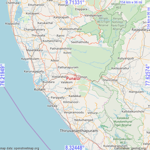
Punalūr GPS coordinates[2]
9° 1' 10.416" North, 76° 55' 21.396" East
| Map corner | latitude | longitude |
|---|---|---|
| Upper-left | 9.71331°, | 76.21949° |
| Center: | 9.01956°, | 76.92261° |
| Lower-right: | 8.32448°, | 77.62574° |
| Map W x H: | 154.4×154.4 km | = 95.9×95.9mi |
| max Lat: | 34.9274° ⇑98.7% North |
| Punalūr: | 9.01956° |
| min Lat: | ⇓1.3% South 8.09008° |
| min Long | Punalūr | max Long |
| 68.82655° | 76.92261° | 96.81° |
| W 35.8%⇐ | ⇒64.2% E |
Elevation
Elevation of Punalūr is 38 m = 125 ft, and this is 257.6 m = 845 ft below average elevation for this country.
| Max E: |
3681 m = 12077 ft | 82.6% |
| Avg. | 295.6 m = 970 ft | |
| Punalūr | 38 m = 125 ft | |
Min E: |
1 m = 3 ft | 17.4% |
See also: Punalūr elevation on elevation.city.
Geographical zone
Punalūr is located in North Torrid zone (between Equator and Tropic of Cancer). Distance of Equator is 1002.9 km =623.2 mi to South.| Distance of | km | miles | from Punalūr |
|---|---|---|---|
| North Pole | 9004.2 | 5594.9 | to North |
| Arctic Circle | 6398.3 | 3975.7 | to North |
| Tropic Cancer | 1603 | 996.1 | to North |
| Equator | 1002.9 | 623.2 | to South |


Nearby cities:
15 places around Punalūr: (largest is in red/bold)
• Adūr
25.9 km =16.1 mi,  305°
305°
• Attingal
37.9 km =23.5 mi,  198°
198°
• Chengannūr
47.2 km =29.3 mi, 314°
• Kadakkavoor
41.5 km =25.8 mi, 204°
• Kadayanallur
46.4 km =28.8 mi,  82°
82°
• Kattanam
43.1 km =26.8 mi,  293°
293°
• Kollam
40.2 km =25 mi,  247°
247°
• Kuttālam
39.4 km =24.5 mi,  104°
104°
• Nedumangād
47.2 km =29.3 mi,  169°
169°
• Paravūr Tekkumbhāgam
37.5 km =23.3 mi,  228°
228°
• Pathanāmthitta
31.4 km =19.5 mi,  330°
330°
• Ponmana
44.2 km =27.5 mi,  268°
268°
• Thenkasi
43.6 km =27.1 mi, 98°
• Varkala
39 km =24.2 mi,  215°
215°
• Vettūr
40 km =24.9 mi,  212°
212°
Sources, notices
• [Note1] Compared only with cities in India existing in our database
• [Src1] Map data: © OpenStreetMap contributors (CC-BY-SA)
• [Src2] Other city data from geonames.org with taken over terms of usage.
• [Src3] Geographical zone / Annual Mean Temperature by Robert A. Rohde @ Wikipedia
