Patiāli geodata
Patiāli (Uttar Pradesh) is a populated place; located in India in Asia/Kolkata (GMT+5.5) time zone. With population of 13,515 people, there are 2612 cities with bigger population in this country. Compared to other cities in India, 83% of cities are located further ↓South; 59% of cities are located further ←West and 55.6% of cities have higher elevation than Patiāli. Note1


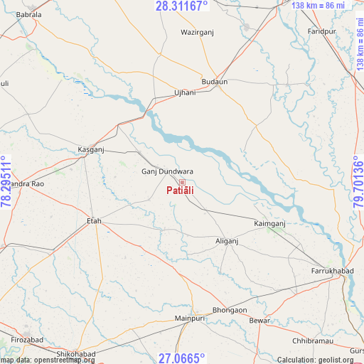
Patiāli GPS coordinates[2]
27° 41' 27.096" North, 78° 59' 53.628" East
| Map corner | latitude | longitude |
|---|---|---|
| Upper-left | 28.31167°, | 78.29511° |
| Center: | 27.69086°, | 78.99823° |
| Lower-right: | 27.0665°, | 79.70136° |
| Map W x H: | 138.4×138.5 km | = 86×86.1mi |
| max Lat: | 34.9274° ⇑17% North |
| Patiāli: | 27.69086° |
| min Lat: | ⇓83% South 8.09008° |
| min Long | Patiāli | max Long |
| 68.82655° | 78.99823° | 96.81° |
| W 59%⇐ | ⇒41% E |
Elevation
Elevation of Patiāli is 172 m = 564 ft, and this is 123.6 m = 406 ft below average elevation for this country.
| Max E: |
3681 m = 12077 ft | 55.6% |
| Avg. | 295.6 m = 970 ft | |
| Patiāli | 172 m = 564 ft | |
Min E: |
1 m = 3 ft | 44.4% |
See also: India elevation on elevation.city.
Geographical zone
Patiāli is located in North temperate zone (between Tropic of Cancer and the Arctic Circle). Distance of this Northern Tropic circle is 473 km =293.9 mi to South.| Distance of | km | miles | from Patiāli |
|---|---|---|---|
| North Pole | 6928.1 | 4304.9 | to North |
| Arctic Circle | 4322.2 | 2685.7 | to North |
| Tropic Cancer | 473 | 293.9 | to South |
| Equator | 3078.9 | 1913.1 | to South |


Nearby cities:
15 places around Patiāli: (largest is in red/bold)
• Alīganj
27.8 km =17.3 mi,  142°
142°
• Amānpur
25.7 km =16 mi,  275°
275°
• Budaun
40.6 km =25.2 mi,  18°
18°
• Ganj Dundwāra
7.3 km =4.5 mi,  309°
309°
• Kaimganj
36.5 km =22.7 mi,  114°
114°
• Kakrāla
29.6 km =18.4 mi,  40°
40°
• Kampil
28.8 km =17.9 mi, 107°
• Kāsganj
37.1 km =23.1 mi,  290°
290°
• Mārahra
42.6 km =26.5 mi, 276°
• Sahāwar
20 km =12.4 mi, 305°
• Sakīt
35.8 km =22.2 mi,  217°
217°
• Sidhpura
14.2 km =8.8 mi,  243°
243°
• Soron
33.3 km =20.7 mi, 311°
• Ujhāni
34.7 km =21.6 mi,  1°
1°
• Usehat
26.4 km =16.4 mi,  63°
63°
Sources, notices
• [Note1] Compared only with cities in India existing in our database
• [Src1] Map data: © OpenStreetMap contributors (CC-BY-SA)
• [Src2] Other city data from geonames.org with taken over terms of usage.
• [Src3] Geographical zone / Annual Mean Temperature by Robert A. Rohde @ Wikipedia
