Pālakkodu geodata
Pālakkodu (Tamil Nadu) is a populated place; located in India in Asia/Kolkata (GMT+5.5) time zone. With population of 19,630 people, there are 2068 cities with bigger population in this country. Compared to other cities in India, 89% of cities are located further ↑North; 50.7% of cities are located further →East and 83.1% of cities have lower elevation than Pālakkodu. Note1


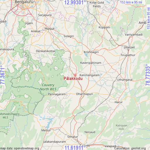
Pālakkodu GPS coordinates[2]
12° 18' 25.056" North, 78° 4' 12.792" East
| Map corner | latitude | longitude |
|---|---|---|
| Upper-left | 12.99301°, | 77.3671° |
| Center: | 12.30696°, | 78.07022° |
| Lower-right: | 11.61911°, | 78.77335° |
| Map W x H: | 152.8×152.8 km | = 94.9×94.9mi |
| max Lat: | 34.9274° ⇑89% North |
| Pālakkodu: | 12.30696° |
| min Lat: | ⇓11% South 8.09008° |
| min Long | Pālakkodu | max Long |
| 68.82655° | 78.07022° | 96.81° |
| W 49.3%⇐ | ⇒50.7% E |
Elevation
Elevation of Pālakkodu is 509 m = 1670 ft, and this is 213.4 m = 700 ft above average elevation for this country.
| Max E: |
3681 m = 12077 ft | 16.9% |
| Pālakkodu | 509 m 1670 ft | |
| Avg. | 295.6 m = 970 ft | |
Min E: |
1 m = 3 ft | 83.1% |
See also: India elevation on elevation.city.
Geographical zone
Pālakkodu is located in North Torrid zone (between Equator and Tropic of Cancer). Distance of this Northern Tropic circle is 1237.5 km =768.9 mi to North.| Distance of | km | miles | from Pālakkodu |
|---|---|---|---|
| North Pole | 8638.7 | 5367.8 | to North |
| Arctic Circle | 6032.8 | 3748.6 | to North |
| Tropic Cancer | 1237.5 | 768.9 | to North |
| Equator | 1368.4 | 850.3 | to South |


Nearby cities:
15 places around Pālakkodu: (largest is in red/bold)
• Denkanikota
39.4 km =24.5 mi,  309°
309°
• Dharmapuri
22.1 km =13.7 mi,  154°
154°
• Harūr
52.8 km =32.8 mi,  122°
122°
• Hosūr
54.3 km =33.7 mi,  331°
331°
• Kelamangalam
40.6 km =25.2 mi,  324°
324°
• Krishnagiri
28.3 km =17.6 mi,  33°
33°
• Kunnattūr
48 km =29.8 mi,  84°
84°
• Kuppam
57.3 km =35.6 mi, 30°
• Kāveripatnam
20.6 km =12.8 mi,  51°
51°
• Mallāpuram
40.9 km =25.4 mi, 151°
• Mārāndahalli
11.6 km =7.2 mi, 321°
• Pallippatti
54.4 km =33.8 mi,  138°
138°
• Pennāgaram
27 km =16.8 mi,  224°
224°
• Pāpireddippatti
54.1 km =33.6 mi, 143°
• Pāppārappatti
9.6 km =6 mi,  187°
187°
Sources, notices
• [Note1] Compared only with cities in India existing in our database
• [Src1] Map data: © OpenStreetMap contributors (CC-BY-SA)
• [Src2] Other city data from geonames.org with taken over terms of usage.
• [Src3] Geographical zone / Annual Mean Temperature by Robert A. Rohde @ Wikipedia
