Hosūr geodata
Hosūr (Tamil Nadu) is a populated place; located in India in Asia/Kolkata (GMT+5.5) time zone. With population of 103,724 people, there are 421 cities with bigger population in this country. Compared to other cities in India, 87.7% of cities are located further ↑North; 53.2% of cities are located further →East and 94.9% of cities have lower elevation than Hosūr. Note1


Hosūr GPS coordinates[2]
12° 44' 11.292" North, 77° 49' 57.504" East
| Map corner | latitude | longitude |
|---|---|---|
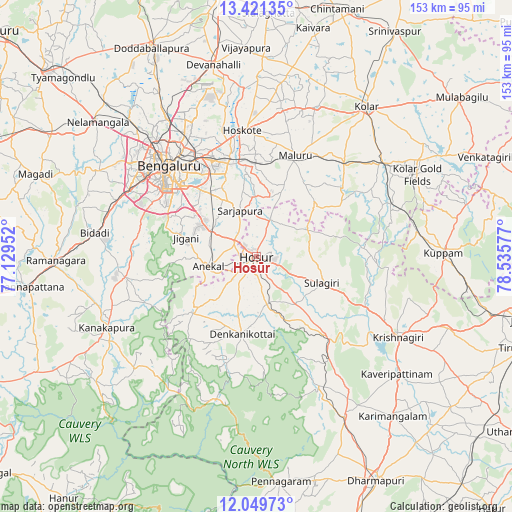
| Upper-left | 13.42135°, | 77.12952° |
| Center: | 12.73647°, | 77.83264° |
| Lower-right: | 12.04973°, | 78.53577° |
| Map W x H: | 152.5×152.5 km | = 94.8×94.8mi |
| max Lat: | 34.9274° ⇑87.7% North |
| Hosūr: | 12.73647° |
| min Lat: | ⇓12.3% South 8.09008° |
| min Long | Hosūr | max Long |
| 68.82655° | 77.83264° | 96.81° |
| W 46.8%⇐ | ⇒53.2% E |
Elevation
Elevation of Hosūr is 871 m = 2858 ft, and this is 575.4 m = 1888 ft above average elevation for this country.
| Max E: |
3681 m = 12077 ft | 5.1% |
| Hosūr | 871 m 2858 ft | |
| Avg. | 295.6 m = 970 ft | |
Min E: |
1 m = 3 ft | 94.9% |
See also: Hosūr elevation on elevation.city.
Geographical zone
Hosūr is located in North Torrid zone (between Equator and Tropic of Cancer). Distance of this Northern Tropic circle is 1189.8 km =739.3 mi to North.| Distance of | km | miles | from Hosūr |
|---|---|---|---|
| North Pole | 8590.9 | 5338.1 | to North |
| Arctic Circle | 5985 | 3718.9 | to North |
| Tropic Cancer | 1189.8 | 739.3 | to North |
| Equator | 1416.2 | 880 | to South |


Nearby cities:
15 places around Hosūr: (largest is in red/bold)
• Anekal
15.1 km =9.4 mi,  259°
259°
• Bangarapet
46.9 km =29.1 mi,  52°
52°
• Bengaluru
36.8 km =22.9 mi,  315°
315°
• Dasarahalli
40.3 km =25 mi,  359°
359°
• Denkanikota
23.4 km =14.5 mi,  191°
191°
• Hoskote
37.4 km =23.2 mi,  354°
354°
• Kelamangalam
15 km =9.3 mi,  171°
171°
• Krishnagiri
47.9 km =29.8 mi,  120°
120°
• Kānkānhalli
49.5 km =30.8 mi,  244°
244°
• Kāveripatnam
54.6 km =33.9 mi,  129°
129°
• Mālūr
31.8 km =19.8 mi,  21°
21°
• Mārāndahalli
42.9 km =26.7 mi,  154°
154°
• Pālakkodu
54.3 km =33.7 mi, 151°
• Robertsonpet
53.9 km =33.5 mi,  63°
63°
• Yelahanka
47.9 km =29.8 mi,  327°
327°
Sources, notices
• [Note1] Compared only with cities in India existing in our database
• [Src1] Map data: © OpenStreetMap contributors (CC-BY-SA)
• [Src2] Other city data from geonames.org with taken over terms of usage.
• [Src3] Geographical zone / Annual Mean Temperature by Robert A. Rohde @ Wikipedia
