Kuppam geodata
Kuppam (Andhra Pradesh) is a populated place; located in India in Asia/Kolkata (GMT+5.5) time zone. With population of 19,854 people, there are 2052 cities with bigger population in this country. Compared to other cities in India, 87.7% of cities are located further ↑North; 52.6% of cities are located further ←West and 92% of cities have lower elevation than Kuppam. Note1


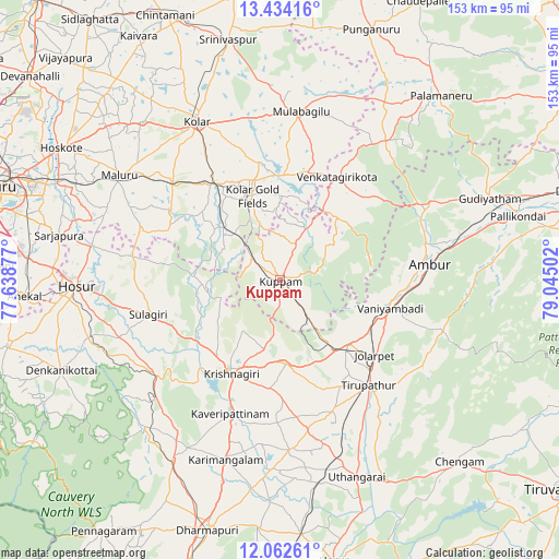
Kuppam GPS coordinates[2]
12° 44' 57.516" North, 78° 20' 30.804" East
| Map corner | latitude | longitude |
|---|---|---|
| Upper-left | 13.43416°, | 77.63877° |
| Center: | 12.74931°, | 78.34189° |
| Lower-right: | 12.06261°, | 79.04502° |
| Map W x H: | 152.5×152.5 km | = 94.8×94.8mi |
| max Lat: | 34.9274° ⇑87.7% North |
| Kuppam: | 12.74931° |
| min Lat: | ⇓12.3% South 8.09008° |
| min Long | Kuppam | max Long |
| 68.82655° | 78.34189° | 96.81° |
| W 52.6%⇐ | ⇒47.4% E |
Elevation
Elevation of Kuppam is 683 m = 2241 ft, and this is 387.4 m = 1271 ft above average elevation for this country.
| Max E: |
3681 m = 12077 ft | 8% |
| Kuppam | 683 m 2241 ft | |
| Avg. | 295.6 m = 970 ft | |
Min E: |
1 m = 3 ft | 92% |
See also: India elevation on elevation.city.
Geographical zone
Kuppam is located in North Torrid zone (between Equator and Tropic of Cancer). Distance of this Northern Tropic circle is 1188.3 km =738.4 mi to North.| Distance of | km | miles | from Kuppam |
|---|---|---|---|
| North Pole | 8589.5 | 5337.3 | to North |
| Arctic Circle | 5983.6 | 3718 | to North |
| Tropic Cancer | 1188.3 | 738.4 | to North |
| Equator | 1417.6 | 880.9 | to South |


Nearby cities:
15 places around Kuppam: (largest is in red/bold)
• Alangāyam
46.7 km =29 mi,  107°
107°
• Ambur
40.9 km =25.4 mi,  83°
83°
• Bangarapet
32.2 km =20 mi,  326°
326°
• Hosūr
55.2 km =34.3 mi,  268°
268°
• Jalārpet
32 km =19.9 mi,  128°
128°
• Kolār
48.9 km =30.4 mi, 331°
• Krishnagiri
29.1 km =18.1 mi,  208°
208°
• Kunnattūr
48.2 km =30 mi,  157°
157°
• Kāveripatnam
38.8 km =24.1 mi,  200°
200°
• Mulbāgal
46.4 km =28.8 mi,  6°
6°
• Mālūr
52.1 km =32.4 mi,  302°
302°
• Mārāndahalli
54.4 km =33.8 mi,  222°
222°
• Peranāmpattu
45.8 km =28.5 mi,  63°
63°
• Robertsonpet
24.1 km =15 mi,  342°
342°
• Vaniyambadi
31.1 km =19.3 mi,  104°
104°
Sources, notices
• [Note1] Compared only with cities in India existing in our database
• [Src1] Map data: © OpenStreetMap contributors (CC-BY-SA)
• [Src2] Other city data from geonames.org with taken over terms of usage.
• [Src3] Geographical zone / Annual Mean Temperature by Robert A. Rohde @ Wikipedia
