Pāchora geodata
Pāchora (Maharashtra) is a populated place; located in India in Asia/Kolkata (GMT+5.5) time zone. With population of 46,823 people, there are 942 cities with bigger population in this country. Compared to other cities in India, 63.2% of cities are located further ↑North; 79.7% of cities are located further →East and 61.5% of cities have lower elevation than Pāchora. Note1


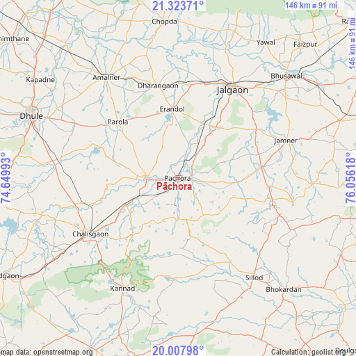
Pāchora GPS coordinates[2]
20° 40' 2.172" North, 75° 21' 10.98" East
| Map corner | latitude | longitude |
|---|---|---|
| Upper-left | 21.32371°, | 74.64993° |
| Center: | 20.66727°, | 75.35305° |
| Lower-right: | 20.00798°, | 76.05618° |
| Map W x H: | 146.3×146.3 km | = 90.9×90.9mi |
| max Lat: | 34.9274° ⇑63.2% North |
| Pāchora: | 20.66727° |
| min Lat: | ⇓36.8% South 8.09008° |
| min Long | Pāchora | max Long |
| 68.82655° | 75.35305° | 96.81° |
| W 20.3%⇐ | ⇒79.7% E |
Elevation
Elevation of Pāchora is 262 m = 860 ft, and this is 33.6 m = 110 ft below average elevation for this country.
| Max E: |
3681 m = 12077 ft | 38.5% |
| Avg. | 295.6 m = 970 ft | |
| Pāchora | 262 m = 860 ft | |
Min E: |
1 m = 3 ft | 61.5% |
See also: Pāchora elevation on elevation.city.
Geographical zone
Pāchora is located in North Torrid zone (between Equator and Tropic of Cancer). Distance of this Northern Tropic circle is 307.9 km =191.3 mi to North.| Distance of | km | miles | from Pāchora |
|---|---|---|---|
| North Pole | 7709.1 | 4790.2 | to North |
| Arctic Circle | 5103.2 | 3171 | to North |
| Tropic Cancer | 307.9 | 191.3 | to North |
| Equator | 2298 | 1427.9 | to South |


Nearby cities:
15 places around Pāchora: (largest is in red/bold)
• Amalner
51.5 km =32 mi,  323°
323°
• Bhusāval
61.4 km =38.2 mi,  47°
47°
• Chopda
64.6 km =40.1 mi,  355°
355°
• Chālisgaon
42.1 km =26.2 mi,  236°
236°
• Dharangaon
39.2 km =24.4 mi,  347°
347°
• Dhūlia
65.3 km =40.6 mi,  293°
293°
• Ellora
74.3 km =46.2 mi,  195°
195°
• Erandol
28.5 km =17.7 mi, 354°
• Jalgaon
43.4 km =27 mi,  30°
30°
• Kannad
50.8 km =31.6 mi,  206°
206°
• Parola
34 km =21.1 mi,  314°
314°
• Sillod
51.1 km =31.8 mi,  142°
142°
• Soygaon
28.6 km =17.8 mi,  106°
106°
• Varangaon
69.8 km =43.4 mi,  56°
56°
• Yāval
66.2 km =41.1 mi, 32°
Sources, notices
• [Note1] Compared only with cities in India existing in our database
• [Src1] Map data: © OpenStreetMap contributors (CC-BY-SA)
• [Src2] Other city data from geonames.org with taken over terms of usage.
• [Src3] Geographical zone / Annual Mean Temperature by Robert A. Rohde @ Wikipedia
