Nārāyangarh geodata
Nārāyangarh (Madhya Pradesh) is a populated place; located in India in Asia/Kolkata (GMT+5.5) time zone. With population of 10,233 people, there are 2918 cities with bigger population in this country. Compared to other cities in India, 59.4% of cities are located further ↓South; 82.3% of cities are located further →East and 79% of cities have lower elevation than Nārāyangarh. Note1


Nārāyangarh GPS coordinates[2]
24° 16' 14.988" North, 75° 3' 0.252" East
| Map corner | latitude | longitude |
|---|---|---|
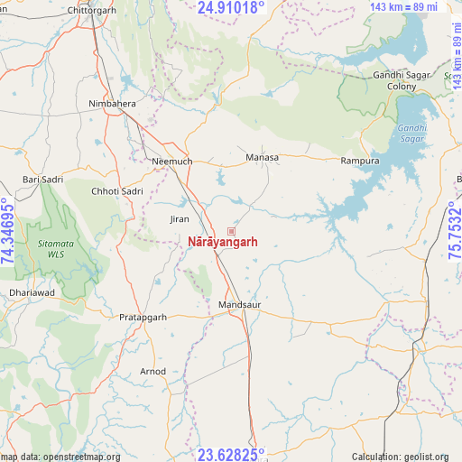
| Upper-left | 24.91018°, | 74.34695° |
| Center: | 24.27083°, | 75.05007° |
| Lower-right: | 23.62825°, | 75.7532° |
| Map W x H: | 142.5×142.5 km | = 88.5×88.5mi |
| max Lat: | 34.9274° ⇑40.6% North |
| Nārāyangarh: | 24.27083° |
| min Lat: | ⇓59.4% South 8.09008° |
| min Long | Nārāyangarh | max Long |
| 68.82655° | 75.05007° | 96.81° |
| W 17.7%⇐ | ⇒82.3% E |
Elevation
Elevation of Nārāyangarh is 445 m = 1460 ft, and this is 149.4 m = 490 ft above average elevation for this country.
| Max E: |
3681 m = 12077 ft | 21% |
| Nārāyangarh | 445 m 1460 ft | |
| Avg. | 295.6 m = 970 ft | |
Min E: |
1 m = 3 ft | 79% |
See also: India elevation on elevation.city.
Geographical zone
Nārāyangarh is located in North temperate zone (between Tropic of Cancer and the Arctic Circle). Distance of this Northern Tropic circle is 92.7 km =57.6 mi to South.| Distance of | km | miles | from Nārāyangarh |
|---|---|---|---|
| North Pole | 7308.4 | 4541.2 | to North |
| Arctic Circle | 4702.5 | 2922 | to North |
| Tropic Cancer | 92.7 | 57.6 | to South |
| Equator | 2698.7 | 1676.9 | to South |


Nearby cities:
15 places around Nārāyangarh: (largest is in red/bold)
• Bari Sādri
60.5 km =37.6 mi,  285°
285°
• Chhoti Sādri
37.4 km =23.2 mi, 289°
• Jāwad
41.1 km =25.5 mi,  332°
332°
• Jīran
16.7 km =10.4 mi,  284°
284°
• Malhārgarh
6.2 km =3.9 mi, 282°
• Mandsaur
22.2 km =13.8 mi,  174°
174°
• Manāsa
24.8 km =15.4 mi,  21°
21°
• Neemuch
29.7 km =18.5 mi,  320°
320°
• Nīmbāhera
54.1 km =33.6 mi, 316°
• Pratāpgarh
38 km =23.6 mi,  225°
225°
• Ratangarh
61.1 km =38 mi,  6°
6°
• Rāmpura
45.1 km =28 mi,  61°
61°
• Shāmgarh
60.4 km =37.5 mi,  98°
98°
• Sītāmau
41.9 km =26 mi,  132°
132°
• Tāl
70.1 km =43.6 mi,  150°
150°
Sources, notices
• [Note1] Compared only with cities in India existing in our database
• [Src1] Map data: © OpenStreetMap contributors (CC-BY-SA)
• [Src2] Other city data from geonames.org with taken over terms of usage.
• [Src3] Geographical zone / Annual Mean Temperature by Robert A. Rohde @ Wikipedia
