Ratangarh geodata
Ratangarh (Madhya Pradesh) is a populated place; located in India in Asia/Kolkata (GMT+5.5) time zone. With population of 7,494 people, there are 3170 cities with bigger population in this country. Compared to other cities in India, 62.5% of cities are located further ↓South; 81.8% of cities are located further →East and 78.7% of cities have lower elevation than Ratangarh. Note1


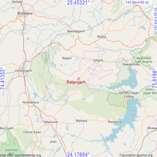
Ratangarh GPS coordinates[2]
24° 49' 0.012" North, 75° 7' 0.012" East
| Map corner | latitude | longitude |
|---|---|---|
| Upper-left | 25.45321°, | 74.41355° |
| Center: | 24.81667°, | 75.11667° |
| Lower-right: | 24.17684°, | 75.8198° |
| Map W x H: | 141.9×141.9 km | = 88.2×88.2mi |
| max Lat: | 34.9274° ⇑37.5% North |
| Ratangarh: | 24.81667° |
| min Lat: | ⇓62.5% South 8.09008° |
| min Long | Ratangarh | max Long |
| 68.82655° | 75.11667° | 96.81° |
| W 18.2%⇐ | ⇒81.8% E |
Elevation
Elevation of Ratangarh is 441 m = 1447 ft, and this is 145.4 m = 477 ft above average elevation for this country.
| Max E: |
3681 m = 12077 ft | 21.3% |
| Ratangarh | 441 m 1447 ft | |
| Avg. | 295.6 m = 970 ft | |
Min E: |
1 m = 3 ft | 78.7% |
See also: India elevation on elevation.city.
Geographical zone
Ratangarh is located in North temperate zone (between Tropic of Cancer and the Arctic Circle). Distance of this Northern Tropic circle is 153.4 km =95.3 mi to South.| Distance of | km | miles | from Ratangarh |
|---|---|---|---|
| North Pole | 7247.7 | 4503.5 | to North |
| Arctic Circle | 4641.8 | 2884.3 | to North |
| Tropic Cancer | 153.4 | 95.3 | to South |
| Equator | 2759.4 | 1714.6 | to South |


Nearby cities:
15 places around Ratangarh: (largest is in red/bold)
• Begūn
22 km =13.7 mi,  327°
327°
• Bhānpura
72.1 km =44.8 mi,  117°
117°
• Chhoti Sādri
64.1 km =39.8 mi,  220°
220°
• Chittaurgarh
50.4 km =31.3 mi,  279°
279°
• Jāwad
35.3 km =21.9 mi,  226°
226°
• Jīran
60.9 km =37.8 mi,  202°
202°
• Malhārgarh
60.7 km =37.7 mi,  192°
192°
• Manāsa
37.8 km =23.5 mi,  176°
176°
• Māndalgarh
42.2 km =26.2 mi,  353°
353°
• Neemuch
45.7 km =28.4 mi,  214°
214°
• Nārāyangarh
61.1 km =38 mi, 186°
• Nīmbāhera
49.1 km =30.5 mi,  243°
243°
• Rāmpura
50.8 km =31.6 mi,  139°
139°
• Rāwatbhāta
49.6 km =30.8 mi,  75°
75°
• Singoli
24.9 km =15.5 mi,  47°
47°
Sources, notices
• [Note1] Compared only with cities in India existing in our database
• [Src1] Map data: © OpenStreetMap contributors (CC-BY-SA)
• [Src2] Other city data from geonames.org with taken over terms of usage.
• [Src3] Geographical zone / Annual Mean Temperature by Robert A. Rohde @ Wikipedia
