Morsi geodata
Morsi (Maharashtra) is a populated place; located in India in Asia/Kolkata (GMT+5.5) time zone. With population of 35,554 people, there are 1219 cities with bigger population in this country. Compared to other cities in India, 59.7% of cities are located further ↑North; 51.2% of cities are located further →East and 72.1% of cities have lower elevation than Morsi. Note1


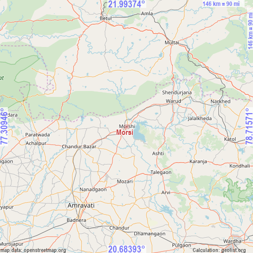
Morsi GPS coordinates[2]
21° 20' 25.08" North, 78° 0' 45.288" East
| Map corner | latitude | longitude |
|---|---|---|
| Upper-left | 21.99374°, | 77.30946° |
| Center: | 21.3403°, | 78.01258° |
| Lower-right: | 20.68393°, | 78.71571° |
| Map W x H: | 145.6×145.6 km | = 90.5×90.5mi |
| max Lat: | 34.9274° ⇑59.7% North |
| Morsi: | 21.3403° |
| min Lat: | ⇓40.3% South 8.09008° |
| min Long | Morsi | max Long |
| 68.82655° | 78.01258° | 96.81° |
| W 48.8%⇐ | ⇒51.2% E |
Elevation
Elevation of Morsi is 351 m = 1152 ft, and this is 55.4 m = 182 ft above average elevation for this country.
| Max E: |
3681 m = 12077 ft | 27.9% |
| Morsi | 351 m 1152 ft | |
| Avg. | 295.6 m = 970 ft | |
Min E: |
1 m = 3 ft | 72.1% |
See also: India elevation on elevation.city.
Geographical zone
Morsi is located in North Torrid zone (between Equator and Tropic of Cancer). Distance of this Northern Tropic circle is 233.1 km =144.8 mi to North.| Distance of | km | miles | from Morsi |
|---|---|---|---|
| North Pole | 7634.2 | 4743.7 | to North |
| Arctic Circle | 5028.4 | 3124.5 | to North |
| Tropic Cancer | 233.1 | 144.8 | to North |
| Equator | 2372.8 | 1474.4 | to South |


Nearby cities:
15 places around Morsi: (largest is in red/bold)
• Achalpur
52.9 km =32.9 mi,  259°
259°
• Amla
66.1 km =41.1 mi,  10°
10°
• Amrāvati
52.8 km =32.8 mi,  211°
211°
• Betūl
63.3 km =39.3 mi,  349°
349°
• Betūl Bazār
58 km =36 mi, 351°
• Bhainsdehi
52.1 km =32.4 mi,  310°
310°
• Chāndūr
58.6 km =36.4 mi,  183°
183°
• Chāndūr Bāzār
29.7 km =18.5 mi,  247°
247°
• Dattāpur
63.6 km =39.5 mi,  167°
167°
• Kātol
59.8 km =37.2 mi,  97°
97°
• Mowād
47.5 km =29.5 mi,  73°
73°
• Multai
54.5 km =33.9 mi,  27°
27°
• Pāndhurnā
60.3 km =37.5 mi,  61°
61°
• Warud
30.3 km =18.8 mi, 61°
• Ārvi
44.4 km =27.6 mi,  149°
149°
Sources, notices
• [Note1] Compared only with cities in India existing in our database
• [Src1] Map data: © OpenStreetMap contributors (CC-BY-SA)
• [Src2] Other city data from geonames.org with taken over terms of usage.
• [Src3] Geographical zone / Annual Mean Temperature by Robert A. Rohde @ Wikipedia
