Betūl Bazār geodata
Betūl Bazār (Madhya Pradesh) is a populated place; located in India in Asia/Kolkata (GMT+5.5) time zone. With population of 9,640 people, there are 2982 cities with bigger population in this country. Compared to other cities in India, 57.2% of cities are located further ↑North; 52.1% of cities are located further →East and 91.1% of cities have lower elevation than Betūl Bazār. Note1


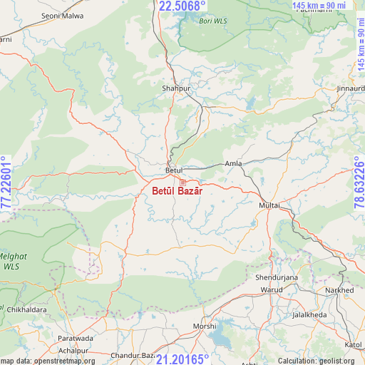
Betūl Bazār GPS coordinates[2]
21° 51' 20.592" North, 77° 55' 44.868" East
| Map corner | latitude | longitude |
|---|---|---|
| Upper-left | 22.5068°, | 77.22601° |
| Center: | 21.85572°, | 77.92913° |
| Lower-right: | 21.20165°, | 78.63226° |
| Map W x H: | 145.1×145.1 km | = 90.2×90.2mi |
| max Lat: | 34.9274° ⇑57.2% North |
| Betūl Bazār: | 21.85572° |
| min Lat: | ⇓42.8% South 8.09008° |
| min Long | Betūl Bazār | max Long |
| 68.82655° | 77.92913° | 96.81° |
| W 47.9%⇐ | ⇒52.1% E |
Elevation
Elevation of Betūl Bazār is 658 m = 2159 ft, and this is 362.4 m = 1189 ft above average elevation for this country.
| Max E: |
3681 m = 12077 ft | 8.9% |
| Betūl Bazār | 658 m 2159 ft | |
| Avg. | 295.6 m = 970 ft | |
Min E: |
1 m = 3 ft | 91.1% |
See also: India elevation on elevation.city.
Geographical zone
Betūl Bazār is located in North Torrid zone (between Equator and Tropic of Cancer). Distance of this Northern Tropic circle is 175.8 km =109.2 mi to North.| Distance of | km | miles | from Betūl Bazār |
|---|---|---|---|
| North Pole | 7576.9 | 4708.1 | to North |
| Arctic Circle | 4971 | 3088.8 | to North |
| Tropic Cancer | 175.8 | 109.2 | to North |
| Equator | 2430.1 | 1510 | to South |


Nearby cities:
15 places around Betūl Bazār: (largest is in red/bold)
• Achalpur
79.5 km =49.4 mi,  213°
213°
• Amla
21.9 km =13.6 mi,  69°
69°
• Betūl
5.7 km =3.5 mi,  330°
330°
• Bhainsdehi
38.8 km =24.1 mi,  232°
232°
• Chāndūr Bāzār
71.2 km =44.2 mi,  195°
195°
• Jāmai
78.1 km =48.5 mi,  60°
60°
• Morsi
58 km =36 mi,  171°
171°
• Mowād
69.3 km =43.1 mi,  128°
128°
• Multai
35.1 km =21.8 mi,  104°
104°
• Pachmarhi
85.6 km =53.2 mi,  37°
37°
• Panara
75 km =46.6 mi, 58°
• Pāndhurnā
68.1 km =42.3 mi,  115°
115°
• Seoni Mālwa
81.5 km =50.6 mi,  324°
324°
• Shāhpur
37.8 km =23.5 mi,  356°
356°
• Warud
55.4 km =34.4 mi,  140°
140°
Sources, notices
• [Note1] Compared only with cities in India existing in our database
• [Src1] Map data: © OpenStreetMap contributors (CC-BY-SA)
• [Src2] Other city data from geonames.org with taken over terms of usage.
• [Src3] Geographical zone / Annual Mean Temperature by Robert A. Rohde @ Wikipedia
