Hāsimāra geodata
Hāsimāra (West Bengal) is a populated place; located in India in Asia/Kolkata (GMT+5.5) time zone. With population of 40,000 people, there are 1103 cities with bigger population in this country. Compared to other cities in India, 76.4% of cities are located further ↓South; 95.3% of cities are located further ←West and 61.8% of cities have higher elevation than Hāsimāra. Note1


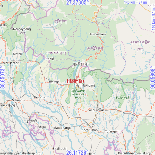
Hāsimāra GPS coordinates[2]
26° 44' 48.84" North, 89° 21' 13.86" East
| Map corner | latitude | longitude |
|---|---|---|
| Upper-left | 27.37305°, | 88.65073° |
| Center: | 26.7469°, | 89.35385° |
| Lower-right: | 26.11728°, | 90.05698° |
| Map W x H: | 139.6×139.6 km | = 86.7×86.7mi |
| max Lat: | 34.9274° ⇑23.6% North |
| Hāsimāra: | 26.7469° |
| min Lat: | ⇓76.4% South 8.09008° |
| min Long | Hāsimāra | max Long |
| 68.82655° | 89.35385° | 96.81° |
| W 95.3%⇐ | ⇒4.7% E |
Elevation
Elevation of Hāsimāra is 139 m = 456 ft, and this is 156.6 m = 514 ft below average elevation for this country.
| Max E: |
3681 m = 12077 ft | 61.8% |
| Avg. | 295.6 m = 970 ft | |
| Hāsimāra | 139 m = 456 ft | |
Min E: |
1 m = 3 ft | 38.2% |
See also: Hāsimāra elevation on elevation.city.
Geographical zone
Hāsimāra is located in North temperate zone (between Tropic of Cancer and the Arctic Circle). Distance of this Northern Tropic circle is 368.1 km =228.7 mi to South.| Distance of | km | miles | from Hāsimāra |
|---|---|---|---|
| North Pole | 7033.1 | 4370.2 | to North |
| Arctic Circle | 4427.2 | 2750.9 | to North |
| Tropic Cancer | 368.1 | 228.7 | to South |
| Equator | 2974 | 1848 | to South |


Nearby cities:
15 places around Hāsimāra: (largest is in red/bold)
• Alīpur Duār
33.8 km =21 mi,  150°
150°
• Birpara
21.2 km =13.2 mi,  257°
257°
• Dhupgāri
38.6 km =24 mi,  242°
242°
• Dīnhāta
68.8 km =42.8 mi,  171°
171°
• Fālākāta
29.3 km =18.2 mi,  210°
210°
• Goshaingaon
69.6 km =43.2 mi,  119°
119°
• Goyerkāta
33 km =20.5 mi, 260°
• Jaigaon
11.4 km =7.1 mi,  10°
10°
• Jalpāiguri
66.8 km =41.5 mi,  247°
247°
• Koch Bihār
47.7 km =29.6 mi, 169°
• Latabāri
70.1 km =43.6 mi,  134°
134°
• Maināguri
56.8 km =35.3 mi, 248°
• Mātābhānga
47.1 km =29.3 mi,  196°
196°
• Odlābāri
72.6 km =45.1 mi,  277°
277°
• Tufānganj
57 km =35.4 mi, 147°
Sources, notices
• [Note1] Compared only with cities in India existing in our database
• [Src1] Map data: © OpenStreetMap contributors (CC-BY-SA)
• [Src2] Other city data from geonames.org with taken over terms of usage.
• [Src3] Geographical zone / Annual Mean Temperature by Robert A. Rohde @ Wikipedia
