Mādugula geodata
Mādugula (Andhra Pradesh) is a populated place; located in India in Asia/Kolkata (GMT+5.5) time zone. With population of 14,741 people, there are 2489 cities with bigger population in this country. Compared to other cities in India, 72% of cities are located further ↑North; 78.8% of cities are located further ←West and 69.1% of cities have higher elevation than Mādugula. Note1


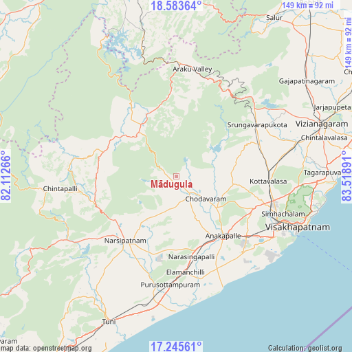
Mādugula GPS coordinates[2]
17° 54' 57.204" North, 82° 48' 56.808" East
| Map corner | latitude | longitude |
|---|---|---|
| Upper-left | 18.58364°, | 82.11266° |
| Center: | 17.91589°, | 82.81578° |
| Lower-right: | 17.24561°, | 83.51891° |
| Map W x H: | 148.8×148.8 km | = 92.5×92.5mi |
| max Lat: | 34.9274° ⇑72% North |
| Mādugula: | 17.91589° |
| min Lat: | ⇓28% South 8.09008° |
| min Long | Mādugula | max Long |
| 68.82655° | 82.81578° | 96.81° |
| W 78.8%⇐ | ⇒21.2% E |
Elevation
Elevation of Mādugula is 97 m = 318 ft, and this is 198.6 m = 652 ft below average elevation for this country.
| Max E: |
3681 m = 12077 ft | 69.1% |
| Avg. | 295.6 m = 970 ft | |
| Mādugula | 97 m = 318 ft | |
Min E: |
1 m = 3 ft | 30.9% |
See also: India elevation on elevation.city.
Geographical zone
Mādugula is located in North Torrid zone (between Equator and Tropic of Cancer). Distance of this Northern Tropic circle is 613.9 km =381.5 mi to North.| Distance of | km | miles | from Mādugula |
|---|---|---|---|
| North Pole | 8015 | 4980.3 | to North |
| Arctic Circle | 5409.1 | 3361.1 | to North |
| Tropic Cancer | 613.9 | 381.5 | to North |
| Equator | 1992.1 | 1237.8 | to South |


Nearby cities:
15 places around Mādugula: (largest is in red/bold)
• Akasahebpet
52.8 km =32.8 mi,  210°
210°
• Anakāpalle
31.9 km =19.8 mi,  141°
141°
• Bhīmunipatnam
67.4 km =41.9 mi,  92°
92°
• Chittarkonda
78.3 km =48.7 mi,  287°
287°
• Chodavaram
15.9 km =9.9 mi,  127°
127°
• Elamanchili
41 km =25.5 mi,  173°
173°
• Etikoppāka
47.1 km =29.3 mi,  190°
190°
• Gajuwaka
48.8 km =30.3 mi,  119°
119°
• Narsīpatnam
35.1 km =21.8 mi,  217°
217°
• Sālūr
78.5 km =48.8 mi,  31°
31°
• Tuni
68.2 km =42.4 mi,  204°
204°
• Vepagunta
45 km =28 mi,  109°
109°
• Visakhapatnam
48.5 km =30.1 mi, 122°
• Vizianagaram
66.8 km =41.5 mi,  70°
70°
• Yārāda
56.3 km =35 mi, 120°
Sources, notices
• [Note1] Compared only with cities in India existing in our database
• [Src1] Map data: © OpenStreetMap contributors (CC-BY-SA)
• [Src2] Other city data from geonames.org with taken over terms of usage.
• [Src3] Geographical zone / Annual Mean Temperature by Robert A. Rohde @ Wikipedia
