Chittarkonda geodata
Chittarkonda (Odisha) is a populated place; located in India in Asia/Kolkata (GMT+5.5) time zone. With population of 7,260 people, there are 3193 cities with bigger population in this country. Compared to other cities in India, 71.5% of cities are located further ↑North; 76.9% of cities are located further ←West and 76.9% of cities have lower elevation than Chittarkonda. Note1


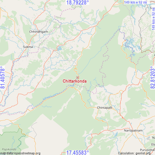
Chittarkonda GPS coordinates[2]
18° 7' 31.188" North, 82° 6' 32.04" East
| Map corner | latitude | longitude |
|---|---|---|
| Upper-left | 18.79228°, | 81.40578° |
| Center: | 18.12533°, | 82.1089° |
| Lower-right: | 17.45583°, | 82.81203° |
| Map W x H: | 148.6×148.6 km | = 92.3×92.3mi |
| max Lat: | 34.9274° ⇑71.5% North |
| Chittarkonda: | 18.12533° |
| min Lat: | ⇓28.5% South 8.09008° |
| min Long | Chittarkonda | max Long |
| 68.82655° | 82.1089° | 96.81° |
| W 76.9%⇐ | ⇒23.1% E |
Elevation
Elevation of Chittarkonda is 414 m = 1358 ft, and this is 118.4 m = 388 ft above average elevation for this country.
| Max E: |
3681 m = 12077 ft | 23.1% |
| Chittarkonda | 414 m 1358 ft | |
| Avg. | 295.6 m = 970 ft | |
Min E: |
1 m = 3 ft | 76.9% |
See also: India elevation on elevation.city.
Geographical zone
Chittarkonda is located in North Torrid zone (between Equator and Tropic of Cancer). Distance of this Northern Tropic circle is 590.6 km =367 mi to North.| Distance of | km | miles | from Chittarkonda |
|---|---|---|---|
| North Pole | 7991.7 | 4965.8 | to North |
| Arctic Circle | 5385.8 | 3346.6 | to North |
| Tropic Cancer | 590.6 | 367 | to North |
| Equator | 2015.3 | 1252.2 | to South |


Nearby cities:
15 places around Chittarkonda: (largest is in red/bold)
• Akasahebpet
84.3 km =52.4 mi,  144°
144°
• Balimila
14 km =8.7 mi,  359°
359°
• Chodavaram
93.4 km =58 mi,  110°
110°
• Elamanchili
101.9 km =63.3 mi,  128°
128°
• Etikoppāka
95.9 km =59.6 mi, 136°
• Gokavaram
100.2 km =62.3 mi,  195°
195°
• Jeypore
94.8 km =58.9 mi,  30°
30°
• Kirandul
106.2 km =66 mi,  302°
302°
• Korāput
99.3 km =61.7 mi,  39°
39°
• Malakanagiri
35.4 km =22 mi,  318°
318°
• Mādugula
78.3 km =48.7 mi, 107°
• Narsīpatnam
73.7 km =45.8 mi, 133°
• Rampachodavaram
83.9 km =52.1 mi, 204°
• Sukma
55.9 km =34.7 mi, 301°
• Tuni
97 km =60.3 mi,  151°
151°
Sources, notices
• [Note1] Compared only with cities in India existing in our database
• [Src1] Map data: © OpenStreetMap contributors (CC-BY-SA)
• [Src2] Other city data from geonames.org with taken over terms of usage.
• [Src3] Geographical zone / Annual Mean Temperature by Robert A. Rohde @ Wikipedia
