Lucknow geodata
Lucknow (Uttar Pradesh) is a seat of a first-order administrative division; located in India in Asia/Kolkata (GMT+5.5) time zone. With population of 2,472,011 people, there are 12 cities with bigger population in this country. Compared to other cities in India, 77.2% of cities are located further ↓South; 72.7% of cities are located further ←West and 64.2% of cities have higher elevation than Lucknow. Note1


Lucknow GPS coordinates[2]
26° 50' 21.408" North, 80° 55' 23.268" East
| Map corner | latitude | longitude |
|---|---|---|
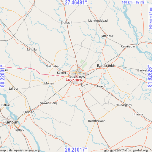
| Upper-left | 27.46491°, | 80.22001° |
| Center: | 26.83928°, | 80.92313° |
| Lower-right: | 26.21017°, | 81.62626° |
| Map W x H: | 139.5×139.5 km | = 86.7×86.7mi |
| max Lat: | 34.9274° ⇑22.8% North |
| Lucknow: | 26.83928° |
| min Lat: | ⇓77.2% South 8.09008° |
| min Long | Lucknow | max Long |
| 68.82655° | 80.92313° | 96.81° |
| W 72.7%⇐ | ⇒27.3% E |
Elevation
Elevation of Lucknow is 126 m = 413 ft, and this is 169.6 m = 556 ft below average elevation for this country.
| Max E: |
3681 m = 12077 ft | 64.2% |
| Avg. | 295.6 m = 970 ft | |
| Lucknow | 126 m = 413 ft | |
Min E: |
1 m = 3 ft | 35.8% |
See also: Lucknow elevation on elevation.city.
Geographical zone
Lucknow is located in North temperate zone (between Tropic of Cancer and the Arctic Circle). Distance of this Northern Tropic circle is 378.3 km =235.1 mi to South.| Distance of | km | miles | from Lucknow |
|---|---|---|---|
| North Pole | 7022.8 | 4363.8 | to North |
| Arctic Circle | 4416.9 | 2744.5 | to North |
| Tropic Cancer | 378.3 | 235.1 | to South |
| Equator | 2984.2 | 1854.3 | to South |


Nearby cities:
15 places around Lucknow: (largest is in red/bold)
• Aurās
42 km =26.1 mi,  281°
281°
• Bachhrāwān
45.2 km =28.1 mi,  154°
154°
• Dewā
32.6 km =20.3 mi,  47°
47°
• Goshāīnganj
19.9 km =12.4 mi,  113°
113°
• Itaunja
27.3 km =17 mi,  354°
354°
• Jagdīshpur
38.8 km =24.1 mi,  255°
255°
• Kākori
14 km =8.7 mi, 283°
• Malīhābād
23 km =14.3 mi,  293°
293°
• Mohān
25.5 km =15.8 mi, 255°
• Nagrām
32.7 km =20.3 mi,  138°
138°
• Nawābganj
29.2 km =18.1 mi,  69°
69°
• Purwā
45 km =28 mi,  199°
199°
• Rasūlābād
44.2 km =27.5 mi, 256°
• Satrikh
27.1 km =16.8 mi,  85°
85°
• Zaidpur
40.3 km =25 mi, 91°
Sources, notices
• [Note1] Compared only with cities in India existing in our database
• [Src1] Map data: © OpenStreetMap contributors (CC-BY-SA)
• [Src2] Other city data from geonames.org with taken over terms of usage.
• [Src3] Geographical zone / Annual Mean Temperature by Robert A. Rohde @ Wikipedia
