Zaidpur geodata
Zaidpur (Uttar Pradesh) is a populated place; located in India in Asia/Kolkata (GMT+5.5) time zone. With population of 33,397 people, there are 1303 cities with bigger population in this country. Compared to other cities in India, 77% of cities are located further ↓South; 74.1% of cities are located further ←West and 64.8% of cities have higher elevation than Zaidpur. Note1


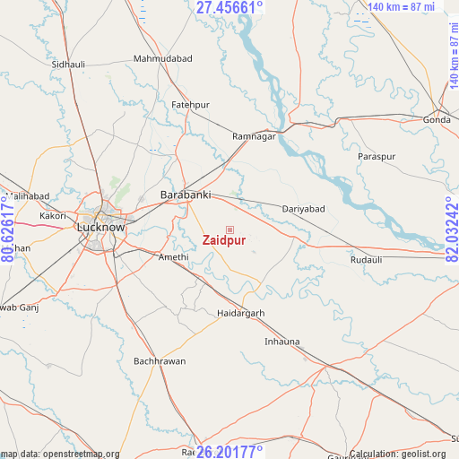
Zaidpur GPS coordinates[2]
26° 49' 51.348" North, 81° 19' 45.444" East
| Map corner | latitude | longitude |
|---|---|---|
| Upper-left | 27.45661°, | 80.62617° |
| Center: | 26.83093°, | 81.32929° |
| Lower-right: | 26.20177°, | 82.03242° |
| Map W x H: | 139.5×139.5 km | = 86.7×86.7mi |
| max Lat: | 34.9274° ⇑23% North |
| Zaidpur: | 26.83093° |
| min Lat: | ⇓77% South 8.09008° |
| min Long | Zaidpur | max Long |
| 68.82655° | 81.32929° | 96.81° |
| W 74.1%⇐ | ⇒25.9% E |
Elevation
Elevation of Zaidpur is 121 m = 397 ft, and this is 174.6 m = 573 ft below average elevation for this country.
| Max E: |
3681 m = 12077 ft | 64.8% |
| Avg. | 295.6 m = 970 ft | |
| Zaidpur | 121 m = 397 ft | |
Min E: |
1 m = 3 ft | 35.2% |
See also: India elevation on elevation.city.
Geographical zone
Zaidpur is located in North temperate zone (between Tropic of Cancer and the Arctic Circle). Distance of this Northern Tropic circle is 377.4 km =234.5 mi to South.| Distance of | km | miles | from Zaidpur |
|---|---|---|---|
| North Pole | 7023.7 | 4364.3 | to North |
| Arctic Circle | 4417.9 | 2745.2 | to North |
| Tropic Cancer | 377.4 | 234.5 | to South |
| Equator | 2983.3 | 1853.7 | to South |


Nearby cities:
15 places around Zaidpur: (largest is in red/bold)
• Bachhrāwān
45.3 km =28.1 mi,  207°
207°
• Colonelganj
49.8 km =30.9 mi,  47°
47°
• Dewā
27.9 km =17.3 mi,  324°
324°
• Fatehpur
39.8 km =24.7 mi,  342°
342°
• Goshāīnganj
23.1 km =14.4 mi,  252°
252°
• Itaunja
51.2 km =31.8 mi,  303°
303°
• Jarwal
42.5 km =26.4 mi,  29°
29°
• Kākori
54.1 km =33.6 mi,  274°
274°
• Lucknow
40.3 km =25 mi, 271°
• Mahārājganj
50.3 km =31.3 mi,  186°
186°
• Nagrām
30.1 km =18.7 mi,  218°
218°
• Nawābganj
17.1 km =10.6 mi,  310°
310°
• Rāmnagar
29.2 km =18.1 mi,  15°
15°
• Satrikh
13.7 km =8.5 mi,  283°
283°
• Tikaitnagar
26.7 km =16.6 mi,  61°
61°
Sources, notices
• [Note1] Compared only with cities in India existing in our database
• [Src1] Map data: © OpenStreetMap contributors (CC-BY-SA)
• [Src2] Other city data from geonames.org with taken over terms of usage.
• [Src3] Geographical zone / Annual Mean Temperature by Robert A. Rohde @ Wikipedia
