Kuchāman geodata
Kuchāman (Rajasthan) is a populated place; located in India in Asia/Kolkata (GMT+5.5) time zone. With population of 56,725 people, there are 781 cities with bigger population in this country. Compared to other cities in India, 79.6% of cities are located further ↓South; 83.9% of cities are located further →East and 75.8% of cities have lower elevation than Kuchāman. Note1


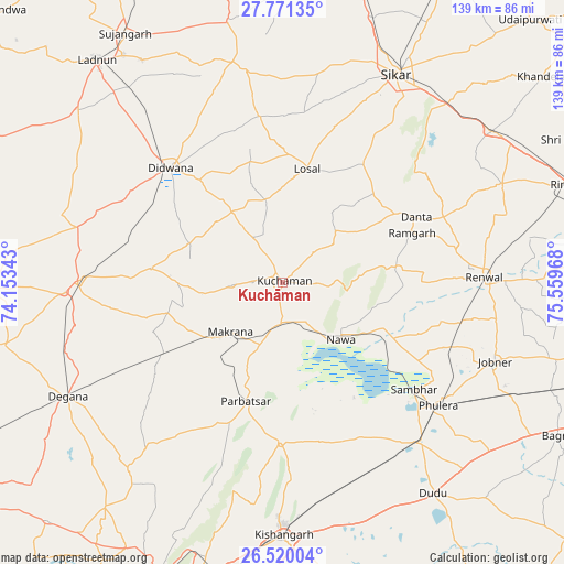
Kuchāman GPS coordinates[2]
27° 8' 50.82" North, 74° 51' 23.58" East
| Map corner | latitude | longitude |
|---|---|---|
| Upper-left | 27.77135°, | 74.15343° |
| Center: | 27.14745°, | 74.85655° |
| Lower-right: | 26.52004°, | 75.55968° |
| Map W x H: | 139.1×139.1 km | = 86.4×86.4mi |
| max Lat: | 34.9274° ⇑20.4% North |
| Kuchāman: | 27.14745° |
| min Lat: | ⇓79.6% South 8.09008° |
| min Long | Kuchāman | max Long |
| 68.82655° | 74.85655° | 96.81° |
| W 16.1%⇐ | ⇒83.9% E |
Elevation
Elevation of Kuchāman is 396 m = 1299 ft, and this is 100.4 m = 329 ft above average elevation for this country.
| Max E: |
3681 m = 12077 ft | 24.2% |
| Kuchāman | 396 m 1299 ft | |
| Avg. | 295.6 m = 970 ft | |
Min E: |
1 m = 3 ft | 75.8% |
See also: Kuchāman elevation on elevation.city.
Geographical zone
Kuchāman is located in North temperate zone (between Tropic of Cancer and the Arctic Circle). Distance of this Northern Tropic circle is 412.6 km =256.4 mi to South.| Distance of | km | miles | from Kuchāman |
|---|---|---|---|
| North Pole | 6988.5 | 4342.5 | to North |
| Arctic Circle | 4382.7 | 2723.3 | to North |
| Tropic Cancer | 412.6 | 256.4 | to South |
| Equator | 3018.5 | 1875.6 | to South |


Nearby cities:
15 places around Kuchāman: (largest is in red/bold)
• Bhuma
71.1 km =44.2 mi,  6°
6°
• Dīdwāna
39.6 km =24.6 mi,  315°
315°
• Jobner
56.1 km =34.9 mi,  110°
110°
• Kishangarh
62 km =38.5 mi,  180°
180°
• Losal
28.7 km =17.8 mi, 11°
• Lādnūn
72.1 km =44.8 mi, 321°
• Makrāna
17.4 km =10.8 mi,  228°
228°
• Meethari Marwar
50.5 km =31.4 mi,  340°
340°
• Naraina
52.7 km =32.7 mi,  138°
138°
• Nāwa
20.3 km =12.6 mi,  134°
134°
• Parvatsar
30.4 km =18.9 mi,  197°
197°
• Phulera
48.8 km =30.3 mi, 128°
• Rāmgarh
33.9 km =21.1 mi,  70°
70°
• Sāmbhar
42.5 km =26.4 mi, 128°
• Sīkar
58.8 km =36.5 mi,  28°
28°
Sources, notices
• [Note1] Compared only with cities in India existing in our database
• [Src1] Map data: © OpenStreetMap contributors (CC-BY-SA)
• [Src2] Other city data from geonames.org with taken over terms of usage.
• [Src3] Geographical zone / Annual Mean Temperature by Robert A. Rohde @ Wikipedia
