Sāmbhar geodata
Sāmbhar (Rajasthan) is a populated place; located in India in Asia/Kolkata (GMT+5.5) time zone. With population of 22,828 people, there are 1844 cities with bigger population in this country. Compared to other cities in India, 77.7% of cities are located further ↓South; 81.1% of cities are located further →East and 74.5% of cities have lower elevation than Sāmbhar. Note1


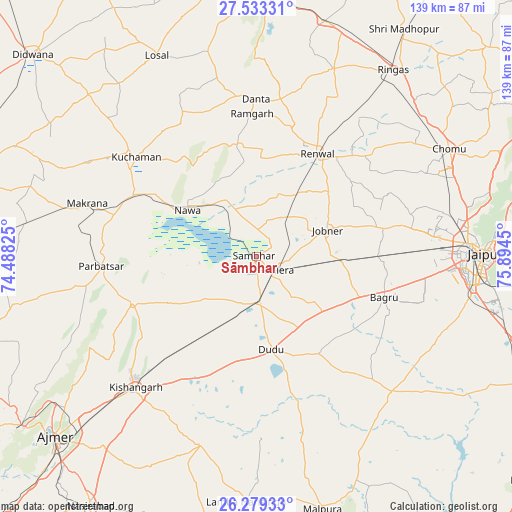
Sāmbhar GPS coordinates[2]
26° 54' 29.016" North, 75° 11' 28.932" East
| Map corner | latitude | longitude |
|---|---|---|
| Upper-left | 27.53331°, | 74.48825° |
| Center: | 26.90806°, | 75.19137° |
| Lower-right: | 26.27933°, | 75.8945° |
| Map W x H: | 139.4×139.4 km | = 86.6×86.6mi |
| max Lat: | 34.9274° ⇑22.3% North |
| Sāmbhar: | 26.90806° |
| min Lat: | ⇓77.7% South 8.09008° |
| min Long | Sāmbhar | max Long |
| 68.82655° | 75.19137° | 96.81° |
| W 18.9%⇐ | ⇒81.1% E |
Elevation
Elevation of Sāmbhar is 379 m = 1243 ft, and this is 83.4 m = 274 ft above average elevation for this country.
| Max E: |
3681 m = 12077 ft | 25.5% |
| Sāmbhar | 379 m 1243 ft | |
| Avg. | 295.6 m = 970 ft | |
Min E: |
1 m = 3 ft | 74.5% |
See also: India elevation on elevation.city.
Geographical zone
Sāmbhar is located in North temperate zone (between Tropic of Cancer and the Arctic Circle). Distance of this Northern Tropic circle is 386 km =239.8 mi to South.| Distance of | km | miles | from Sāmbhar |
|---|---|---|---|
| North Pole | 7015.2 | 4359 | to North |
| Arctic Circle | 4409.3 | 2739.8 | to North |
| Tropic Cancer | 386 | 239.8 | to South |
| Equator | 2991.9 | 1859.1 | to South |


Nearby cities:
15 places around Sāmbhar: (largest is in red/bold)
• Ajmer
74.7 km =46.4 mi,  227°
227°
• Jaipur
59.1 km =36.7 mi,  88°
88°
• Jobner
20.7 km =12.9 mi,  69°
69°
• Kishangarh
48.7 km =30.3 mi,  223°
223°
• Kuchāman
42.5 km =26.4 mi,  308°
308°
• Losal
61.1 km =38 mi,  333°
333°
• Makrāna
48.7 km =30.3 mi,  288°
288°
• Mālpura
71.5 km =44.4 mi,  166°
166°
• Naraina
13.1 km =8.1 mi, 173°
• Nāwa
22.5 km =14 mi,  303°
303°
• Parvatsar
42.2 km =26.2 mi,  266°
266°
• Phulera
6.3 km =3.9 mi,  127°
127°
• Rāmgarh
38.1 km =23.7 mi,  358°
358°
• Rīngas
62.9 km =39.1 mi,  36°
36°
• Sri Mādhopur
73.9 km =45.9 mi,  32°
32°
Sources, notices
• [Note1] Compared only with cities in India existing in our database
• [Src1] Map data: © OpenStreetMap contributors (CC-BY-SA)
• [Src2] Other city data from geonames.org with taken over terms of usage.
• [Src3] Geographical zone / Annual Mean Temperature by Robert A. Rohde @ Wikipedia
