Kātoya geodata
Kātoya (West Bengal) is a populated place; located in India in Asia/Kolkata (GMT+5.5) time zone. With population of 78,408 people, there are 557 cities with bigger population in this country. Compared to other cities in India, 55.8% of cities are located further ↓South; 91.5% of cities are located further ←West and 88.1% of cities have higher elevation than Kātoya. Note1


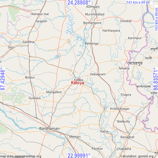
Kātoya GPS coordinates[2]
23° 38' 44.088" North, 88° 7' 57.288" East
| Map corner | latitude | longitude |
|---|---|---|
| Upper-left | 24.28808°, | 87.42946° |
| Center: | 23.64558°, | 88.13258° |
| Lower-right: | 22.99991°, | 88.83571° |
| Map W x H: | 143.2×143.2 km | = 89×89mi |
| max Lat: | 34.9274° ⇑44.2% North |
| Kātoya: | 23.64558° |
| min Lat: | ⇓55.8% South 8.09008° |
| min Long | Kātoya | max Long |
| 68.82655° | 88.13258° | 96.81° |
| W 91.5%⇐ | ⇒8.5% E |
Elevation
Elevation of Kātoya is 22 m = 72 ft, and this is 273.6 m = 898 ft below average elevation for this country.
| Max E: |
3681 m = 12077 ft | 88.1% |
| Avg. | 295.6 m = 970 ft | |
| Kātoya | 22 m = 72 ft | |
Min E: |
1 m = 3 ft | 11.9% |
See also: Kātoya elevation on elevation.city.
Geographical zone
Kātoya is located in North temperate zone (between Tropic of Cancer and the Arctic Circle). Distance of this Northern Tropic circle is 23.2 km =14.4 mi to South.| Distance of | km | miles | from Kātoya |
|---|---|---|---|
| North Pole | 7377.9 | 4584.4 | to North |
| Arctic Circle | 4772 | 2965.2 | to North |
| Tropic Cancer | 23.2 | 14.4 | to South |
| Equator | 2629.1 | 1633.6 | to South |


Nearby cities:
15 places around Kātoya: (largest is in red/bold)
• Ahmadpur
49.8 km =30.9 mi,  294°
294°
• Baharampur
52.5 km =32.6 mi,  13°
13°
• Barddhamān
51.7 km =32.1 mi,  212°
212°
• Beldānga
34.6 km =21.5 mi,  22°
22°
• Bolpur
44.4 km =27.6 mi,  272°
272°
• Guskhara
44 km =27.3 mi,  247°
247°
• Krishnanagar
45.2 km =28.1 mi,  126°
126°
• Kālna
52.9 km =32.9 mi,  153°
153°
• Kāndi
36.1 km =22.4 mi,  344°
344°
• Memāri
52.3 km =32.5 mi,  183°
183°
• Muragācha
29.3 km =18.2 mi,  114°
114°
• Navadwīp
35.8 km =22.2 mi,  137°
137°
• Pātuli
17 km =10.6 mi, 127°
• Sainthia
57 km =35.4 mi,  306°
306°
• Shāntipur
53.9 km =33.5 mi, 145°
Sources, notices
• [Note1] Compared only with cities in India existing in our database
• [Src1] Map data: © OpenStreetMap contributors (CC-BY-SA)
• [Src2] Other city data from geonames.org with taken over terms of usage.
• [Src3] Geographical zone / Annual Mean Temperature by Robert A. Rohde @ Wikipedia
