Jaorā geodata
Jaorā (Madhya Pradesh) is a populated place; located in India in Asia/Kolkata (GMT+5.5) time zone. With population of 67,203 people, there are 646 cities with bigger population in this country. Compared to other cities in India, 55.7% of cities are located further ↓South; 81.6% of cities are located further →East and 80.9% of cities have lower elevation than Jaorā. Note1


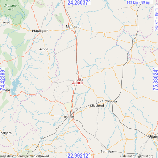
Jaorā GPS coordinates[2]
23° 38' 16.188" North, 75° 7' 37.596" East
| Map corner | latitude | longitude |
|---|---|---|
| Upper-left | 24.28037°, | 74.42399° |
| Center: | 23.63783°, | 75.12711° |
| Lower-right: | 22.99212°, | 75.83024° |
| Map W x H: | 143.2×143.2 km | = 89×89mi |
| max Lat: | 34.9274° ⇑44.3% North |
| Jaorā: | 23.63783° |
| min Lat: | ⇓55.7% South 8.09008° |
| min Long | Jaorā | max Long |
| 68.82655° | 75.12711° | 96.81° |
| W 18.4%⇐ | ⇒81.6% E |
Elevation
Elevation of Jaorā is 473 m = 1552 ft, and this is 177.4 m = 582 ft above average elevation for this country.
| Max E: |
3681 m = 12077 ft | 19.1% |
| Jaorā | 473 m 1552 ft | |
| Avg. | 295.6 m = 970 ft | |
Min E: |
1 m = 3 ft | 80.9% |
See also: Jaorā elevation on elevation.city.
Geographical zone
Jaorā is located in North temperate zone (between Tropic of Cancer and the Arctic Circle). Distance of this Northern Tropic circle is 22.4 km =13.9 mi to South.| Distance of | km | miles | from Jaorā |
|---|---|---|---|
| North Pole | 7378.8 | 4585 | to North |
| Arctic Circle | 4772.9 | 2965.7 | to North |
| Tropic Cancer | 22.4 | 13.9 | to South |
| Equator | 2628.3 | 1633.1 | to South |


Nearby cities:
15 places around Jaorā: (largest is in red/bold)
• Alot
45.9 km =28.5 mi,  72°
72°
• Badnāwar
69.3 km =43.1 mi,  171°
171°
• Bānswāra
70.6 km =43.9 mi,  261°
261°
• Gogāpur
40.7 km =25.3 mi,  102°
102°
• Khāchrod
28.6 km =17.8 mi,  146°
146°
• Mandsaur
48.6 km =30.2 mi,  353°
353°
• Nagda
35.7 km =22.2 mi,  123°
123°
• Namli
20.8 km =12.9 mi,  199°
199°
• Piploda
44.7 km =27.8 mi,  135°
135°
• Pratāpgarh
56.2 km =34.9 mi,  321°
321°
• Ratlām
35.3 km =21.9 mi,  194°
194°
• Sailāna
28.5 km =17.7 mi,  226°
226°
• Sītāmau
47.8 km =29.7 mi,  28°
28°
• Tāl
27.8 km =17.3 mi, 70°
• Unhel
55.3 km =34.4 mi,  127°
127°
Sources, notices
• [Note1] Compared only with cities in India existing in our database
• [Src1] Map data: © OpenStreetMap contributors (CC-BY-SA)
• [Src2] Other city data from geonames.org with taken over terms of usage.
• [Src3] Geographical zone / Annual Mean Temperature by Robert A. Rohde @ Wikipedia
