Bānswāra geodata
Bānswāra (Rajasthan) is a populated place; located in India in Asia/Kolkata (GMT+5.5) time zone. With population of 93,648 people, there are 476 cities with bigger population in this country. Compared to other cities in India, 55.1% of cities are located further ↓South; 87.3% of cities are located further →East and 55.1% of cities have lower elevation than Bānswāra. Note1


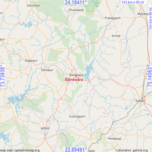
Bānswāra GPS coordinates[2]
23° 32' 27.924" North, 74° 26' 33" East
| Map corner | latitude | longitude |
|---|---|---|
| Upper-left | 24.18411°, | 73.73938° |
| Center: | 23.54109°, | 74.4425° |
| Lower-right: | 22.89491°, | 75.14563° |
| Map W x H: | 143.3×143.3 km | = 89×89mi |
| max Lat: | 34.9274° ⇑44.9% North |
| Bānswāra: | 23.54109° |
| min Lat: | ⇓55.1% South 8.09008° |
| min Long | Bānswāra | max Long |
| 68.82655° | 74.4425° | 96.81° |
| W 12.7%⇐ | ⇒87.3% E |
Elevation
Elevation of Bānswāra is 227 m = 745 ft, and this is 68.6 m = 225 ft below average elevation for this country.
| Max E: |
3681 m = 12077 ft | 44.9% |
| Avg. | 295.6 m = 970 ft | |
| Bānswāra | 227 m = 745 ft | |
Min E: |
1 m = 3 ft | 55.1% |
See also: Bānswāra elevation on elevation.city.
Geographical zone
Bānswāra is located in North temperate zone (between Tropic of Cancer and the Arctic Circle). Distance of this Northern Tropic circle is 11.6 km =7.2 mi to South.| Distance of | km | miles | from Bānswāra |
|---|---|---|---|
| North Pole | 7389.5 | 4591.6 | to North |
| Arctic Circle | 4783.7 | 2972.5 | to North |
| Tropic Cancer | 11.6 | 7.2 | to South |
| Equator | 2617.5 | 1626.4 | to South |


Nearby cities:
15 places around Bānswāra: (largest is in red/bold)
• Bamna
59.4 km =36.9 mi,  146°
146°
• Dohad
80.9 km =50.3 mi,  193°
193°
• Dūngarpur
81.4 km =50.6 mi,  294°
294°
• Galiākot
43.1 km =26.8 mi,  266°
266°
• Jaorā
70.6 km =43.9 mi,  81°
81°
• Khāchrod
86.6 km =53.8 mi,  98°
98°
• Kushālgarh
38 km =23.6 mi,  178°
178°
• Namli
63.6 km =39.5 mi, 98°
• Partāpur
28 km =17.4 mi,  281°
281°
• Petlāwad
69.2 km =43 mi, 148°
• Pratāpgarh
64.6 km =40.1 mi,  32°
32°
• Ratlām
65.3 km =40.6 mi,  111°
111°
• Sailāna
49.8 km =30.9 mi, 100°
• Sālūmbar
77.5 km =48.2 mi,  328°
328°
• Thandla
60.7 km =37.7 mi,  166°
166°
Sources, notices
• [Note1] Compared only with cities in India existing in our database
• [Src1] Map data: © OpenStreetMap contributors (CC-BY-SA)
• [Src2] Other city data from geonames.org with taken over terms of usage.
• [Src3] Geographical zone / Annual Mean Temperature by Robert A. Rohde @ Wikipedia
