Gogāpur geodata
Gogāpur (Madhya Pradesh) is a populated place; located in India in Asia/Kolkata (GMT+5.5) time zone. With population of 6,857 people, there are 3224 cities with bigger population in this country. Compared to other cities in India, 55.2% of cities are located further ↓South; 78.4% of cities are located further →East and 81.9% of cities have lower elevation than Gogāpur. Note1


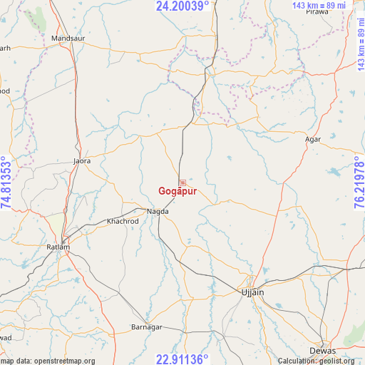
Gogāpur GPS coordinates[2]
23° 33' 26.856" North, 75° 30' 59.94" East
| Map corner | latitude | longitude |
|---|---|---|
| Upper-left | 24.20039°, | 74.81353° |
| Center: | 23.55746°, | 75.51665° |
| Lower-right: | 22.91136°, | 76.21978° |
| Map W x H: | 143.3×143.3 km | = 89×89mi |
| max Lat: | 34.9274° ⇑44.8% North |
| Gogāpur: | 23.55746° |
| min Lat: | ⇓55.2% South 8.09008° |
| min Long | Gogāpur | max Long |
| 68.82655° | 75.51665° | 96.81° |
| W 21.6%⇐ | ⇒78.4% E |
Elevation
Elevation of Gogāpur is 491 m = 1611 ft, and this is 195.4 m = 641 ft above average elevation for this country.
| Max E: |
3681 m = 12077 ft | 18.1% |
| Gogāpur | 491 m 1611 ft | |
| Avg. | 295.6 m = 970 ft | |
Min E: |
1 m = 3 ft | 81.9% |
See also: India elevation on elevation.city.
Geographical zone
Gogāpur is located in North temperate zone (between Tropic of Cancer and the Arctic Circle). Distance of this Northern Tropic circle is 13.4 km =8.3 mi to South.| Distance of | km | miles | from Gogāpur |
|---|---|---|---|
| North Pole | 7387.7 | 4590.5 | to North |
| Arctic Circle | 4781.8 | 2971.3 | to North |
| Tropic Cancer | 13.4 | 8.3 | to South |
| Equator | 2619.3 | 1627.6 | to South |


Nearby cities:
15 places around Gogāpur: (largest is in red/bold)
• Agar
53.7 km =33.4 mi,  71°
71°
• Alot
23.3 km =14.5 mi,  10°
10°
• Gautampura
63.5 km =39.5 mi,  179°
179°
• Jaorā
40.7 km =25.3 mi,  282°
282°
• Khāchrod
28.2 km =17.5 mi,  238°
238°
• Nagda
14.9 km =9.3 mi,  222°
222°
• Namli
47.7 km =29.6 mi,  257°
257°
• Piploda
24.6 km =15.3 mi,  200°
200°
• Ratlām
54.8 km =34.1 mi, 242°
• Sailāna
61.4 km =38.2 mi, 260°
• Sītāmau
53.5 km =33.2 mi,  341°
341°
• Tarāna
59.1 km =36.7 mi,  114°
114°
• Tāl
22.5 km =14 mi,  323°
323°
• Ujjain
49.4 km =30.7 mi,  147°
147°
• Unhel
24.8 km =15.4 mi,  169°
169°
Sources, notices
• [Note1] Compared only with cities in India existing in our database
• [Src1] Map data: © OpenStreetMap contributors (CC-BY-SA)
• [Src2] Other city data from geonames.org with taken over terms of usage.
• [Src3] Geographical zone / Annual Mean Temperature by Robert A. Rohde @ Wikipedia
