Hole Narsipur geodata
Hole Narsipur (Karnataka) is a populated place; located in India in Asia/Kolkata (GMT+5.5) time zone. With population of 28,285 people, there are 1525 cities with bigger population in this country. Compared to other cities in India, 87.5% of cities are located further ↑North; 71.2% of cities are located further →East and 94.5% of cities have lower elevation than Hole Narsipur. Note1


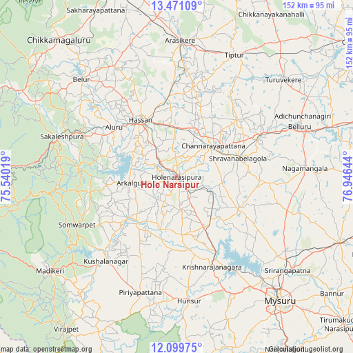
Hole Narsipur GPS coordinates[2]
12° 47' 10.86" North, 76° 14' 35.916" East
| Map corner | latitude | longitude |
|---|---|---|
| Upper-left | 13.47109°, | 75.54019° |
| Center: | 12.78635°, | 76.24331° |
| Lower-right: | 12.09975°, | 76.94644° |
| Map W x H: | 152.5×152.5 km | = 94.8×94.8mi |
| max Lat: | 34.9274° ⇑87.5% North |
| Hole Narsipur: | 12.78635° |
| min Lat: | ⇓12.5% South 8.09008° |
| min Long | Hole Narsipur | max Long |
| 68.82655° | 76.24331° | 96.81° |
| W 28.8%⇐ | ⇒71.2% E |
Elevation
Elevation of Hole Narsipur is 845 m = 2772 ft, and this is 549.4 m = 1802 ft above average elevation for this country.
| Max E: |
3681 m = 12077 ft | 5.5% |
| Hole Narsipur | 845 m 2772 ft | |
| Avg. | 295.6 m = 970 ft | |
Min E: |
1 m = 3 ft | 94.5% |
See also: India elevation on elevation.city.
Geographical zone
Hole Narsipur is located in North Torrid zone (between Equator and Tropic of Cancer). Distance of this Northern Tropic circle is 1184.2 km =735.8 mi to North.| Distance of | km | miles | from Hole Narsipur |
|---|---|---|---|
| North Pole | 8585.4 | 5334.7 | to North |
| Arctic Circle | 5979.5 | 3715.5 | to North |
| Tropic Cancer | 1184.2 | 735.8 | to North |
| Equator | 1421.7 | 883.4 | to South |


Nearby cities:
15 places around Hole Narsipur: (largest is in red/bold)
• Alūr
34.7 km =21.6 mi,  307°
307°
• Arkalgūd
20 km =12.4 mi,  262°
262°
• Channarāyapatna
20.6 km =12.8 mi,  49°
49°
• Gorūr
19.8 km =12.3 mi,  281°
281°
• Hassan
29.3 km =18.2 mi,  326°
326°
• Kodlipet
38.7 km =24 mi,  272°
272°
• Konanūr
27.2 km =16.9 mi,  230°
230°
• Krishnarājpet
29.7 km =18.5 mi,  116°
116°
• Kushālnagar
47.8 km =29.7 mi,  220°
220°
• Melukote
46.1 km =28.6 mi,  107°
107°
• Piriyāpatna
52.5 km =32.6 mi,  197°
197°
• Sakleshpur
52.6 km =32.7 mi,  289°
289°
• Sanivārsante
39.2 km =24.4 mi, 260°
• Somvārpet
47.6 km =29.6 mi,  243°
243°
• Srāvana Belgola
27.8 km =17.3 mi,  73°
73°
Sources, notices
• [Note1] Compared only with cities in India existing in our database
• [Src1] Map data: © OpenStreetMap contributors (CC-BY-SA)
• [Src2] Other city data from geonames.org with taken over terms of usage.
• [Src3] Geographical zone / Annual Mean Temperature by Robert A. Rohde @ Wikipedia
