Gadwāl geodata
Gadwāl (Telangana) is a seat of a second-order administrative division; located in India in Asia/Kolkata (GMT+5.5) time zone. With population of 55,952 people, there are 796 cities with bigger population in this country. Compared to other cities in India, 77.3% of cities are located further ↑North; 53.7% of cities are located further →East and 69.9% of cities have lower elevation than Gadwāl. Note1


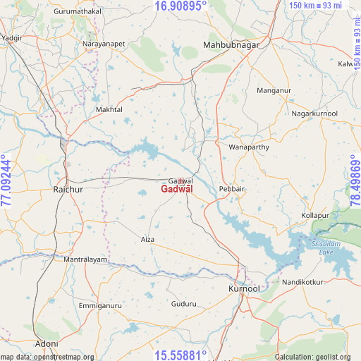
Gadwāl GPS coordinates[2]
16° 14' 6.144" North, 77° 47' 44.016" East
| Map corner | latitude | longitude |
|---|---|---|
| Upper-left | 16.90895°, | 77.09244° |
| Center: | 16.23504°, | 77.79556° |
| Lower-right: | 15.55881°, | 78.49869° |
| Map W x H: | 150.1×150.1 km | = 93.3×93.3mi |
| max Lat: | 34.9274° ⇑77.3% North |
| Gadwāl: | 16.23504° |
| min Lat: | ⇓22.7% South 8.09008° |
| min Long | Gadwāl | max Long |
| 68.82655° | 77.79556° | 96.81° |
| W 46.3%⇐ | ⇒53.7% E |
Elevation
Elevation of Gadwāl is 326 m = 1070 ft, and this is 30.4 m = 100 ft above average elevation for this country.
| Max E: |
3681 m = 12077 ft | 30.1% |
| Gadwāl | 326 m 1070 ft | |
| Avg. | 295.6 m = 970 ft | |
Min E: |
1 m = 3 ft | 69.9% |
See also: Gadwāl elevation on elevation.city.
Geographical zone
Gadwāl is located in North Torrid zone (between Equator and Tropic of Cancer). Distance of this Northern Tropic circle is 800.8 km =497.6 mi to North.| Distance of | km | miles | from Gadwāl |
|---|---|---|---|
| North Pole | 8201.9 | 5096.4 | to North |
| Arctic Circle | 5596 | 3477.2 | to North |
| Tropic Cancer | 800.8 | 497.6 | to North |
| Equator | 1805.2 | 1121.7 | to South |


Nearby cities:
15 places around Gadwāl: (largest is in red/bold)
• Emmiganūr
61.3 km =38.1 mi,  212°
212°
• Gopālur
42 km =26.1 mi,  1°
1°
• Gurmatkāl
82.5 km =51.3 mi,  328°
328°
• Kosigi
72.5 km =45 mi,  234°
234°
• Kurnool
52 km =32.3 mi,  150°
150°
• Mahbūbnagar
60.1 km =37.3 mi,  19°
19°
• Mānvi
84.1 km =52.3 mi,  251°
251°
• Nandikotkūr
65.5 km =40.7 mi,  129°
129°
• Nāgar Karnūl
62.8 km =39 mi,  64°
64°
• Nārāyanpet
65.4 km =40.6 mi, 330°
• Rāichūr
47.1 km =29.3 mi,  265°
265°
• Wanparti
32.7 km =20.3 mi, 63°
• Yādgīr
92 km =57.2 mi,  310°
310°
• Ādoni
87.5 km =54.4 mi,  219°
219°
• Ālampur
53.5 km =33.2 mi,  137°
137°
Sources, notices
• [Note1] Compared only with cities in India existing in our database
• [Src1] Map data: © OpenStreetMap contributors (CC-BY-SA)
• [Src2] Other city data from geonames.org with taken over terms of usage.
• [Src3] Geographical zone / Annual Mean Temperature by Robert A. Rohde @ Wikipedia
