Chandauli geodata
Chandauli (Uttar Pradesh) is a populated place; located in India in Asia/Kolkata (GMT+5.5) time zone. With population of 25,035 people, there are 1698 cities with bigger population in this country. Compared to other cities in India, 64.9% of cities are located further ↓South; 80.2% of cities are located further ←West and 72.7% of cities have higher elevation than Chandauli. Note1


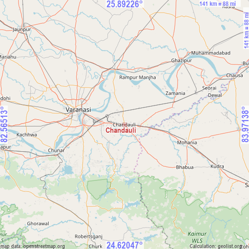
Chandauli GPS coordinates[2]
25° 15' 28.908" North, 83° 16' 5.7" East
| Map corner | latitude | longitude |
|---|---|---|
| Upper-left | 25.89226°, | 82.56513° |
| Center: | 25.25803°, | 83.26825° |
| Lower-right: | 24.62047°, | 83.97138° |
| Map W x H: | 141.4×141.4 km | = 87.9×87.9mi |
| max Lat: | 34.9274° ⇑35.1% North |
| Chandauli: | 25.25803° |
| min Lat: | ⇓64.9% South 8.09008° |
| min Long | Chandauli | max Long |
| 68.82655° | 83.26825° | 96.81° |
| W 80.2%⇐ | ⇒19.8% E |
Elevation
Elevation of Chandauli is 81 m = 266 ft, and this is 214.6 m = 704 ft below average elevation for this country.
| Max E: |
3681 m = 12077 ft | 72.7% |
| Avg. | 295.6 m = 970 ft | |
| Chandauli | 81 m = 266 ft | |
Min E: |
1 m = 3 ft | 27.3% |
See also: India elevation on elevation.city.
Geographical zone
Chandauli is located in North temperate zone (between Tropic of Cancer and the Arctic Circle). Distance of this Northern Tropic circle is 202.5 km =125.8 mi to South.| Distance of | km | miles | from Chandauli |
|---|---|---|---|
| North Pole | 7198.6 | 4473 | to North |
| Arctic Circle | 4592.7 | 2853.8 | to North |
| Tropic Cancer | 202.5 | 125.8 | to South |
| Equator | 2808.4 | 1745.1 | to South |


Nearby cities:
15 places around Chandauli: (largest is in red/bold)
• Ahraura
35.9 km =22.3 mi,  221°
221°
• Barāgaon
49.2 km =30.6 mi,  292°
292°
• Bhabhua
41.8 km =26 mi,  125°
125°
• Chakia
23.7 km =14.7 mi,  191°
191°
• Chunār
41.5 km =25.8 mi,  249°
249°
• Ghazīpur
48.2 km =30 mi,  41°
41°
• Kachhwa
56 km =34.8 mi,  264°
264°
• Kirākat
55.1 km =34.2 mi,  320°
320°
• Mughal Sarāi
15.2 km =9.4 mi,  280°
280°
• Muhammadābād
63.3 km =39.3 mi,  50°
50°
• Rāmnagar
24 km =14.9 mi,  272°
272°
• Saidpur
31.4 km =19.5 mi,  351°
351°
• Sādāt
46.1 km =28.6 mi,  4°
4°
• Varanasi
26.7 km =16.6 mi, 284°
• Zamānia
34.2 km =21.3 mi,  58°
58°
Sources, notices
• [Note1] Compared only with cities in India existing in our database
• [Src1] Map data: © OpenStreetMap contributors (CC-BY-SA)
• [Src2] Other city data from geonames.org with taken over terms of usage.
• [Src3] Geographical zone / Annual Mean Temperature by Robert A. Rohde @ Wikipedia
