Bāsudebpur geodata
Bāsudebpur (Odisha) is a populated place; located in India in Asia/Kolkata (GMT+5.5) time zone. With population of 31,827 people, there are 1368 cities with bigger population in this country. Compared to other cities in India, 61.1% of cities are located further ↑North; 88.8% of cities are located further ←West and 92.8% of cities have higher elevation than Bāsudebpur. Note1


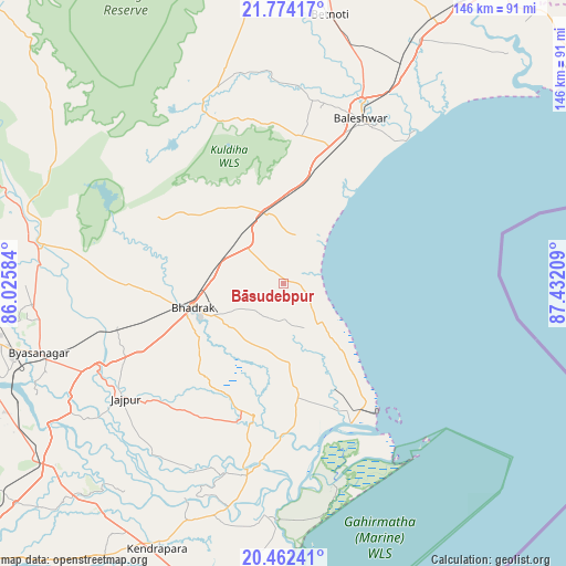
Bāsudebpur GPS coordinates[2]
21° 7' 11.064" North, 86° 43' 44.256" East
| Map corner | latitude | longitude |
|---|---|---|
| Upper-left | 21.77417°, | 86.02584° |
| Center: | 21.11974°, | 86.72896° |
| Lower-right: | 20.46241°, | 87.43209° |
| Map W x H: | 145.9×145.9 km | = 90.7×90.7mi |
| max Lat: | 34.9274° ⇑61.1% North |
| Bāsudebpur: | 21.11974° |
| min Lat: | ⇓38.9% South 8.09008° |
| min Long | Bāsudebpur | max Long |
| 68.82655° | 86.72896° | 96.81° |
| W 88.8%⇐ | ⇒11.2% E |
Elevation
Elevation of Bāsudebpur is 14 m = 46 ft, and this is 281.6 m = 924 ft below average elevation for this country.
| Max E: |
3681 m = 12077 ft | 92.8% |
| Avg. | 295.6 m = 970 ft | |
| Bāsudebpur | 14 m = 46 ft | |
Min E: |
1 m = 3 ft | 7.2% |
See also: India elevation on elevation.city.
Geographical zone
Bāsudebpur is located in North Torrid zone (between Equator and Tropic of Cancer). Distance of this Northern Tropic circle is 257.6 km =160.1 mi to North.| Distance of | km | miles | from Bāsudebpur |
|---|---|---|---|
| North Pole | 7658.8 | 4759 | to North |
| Arctic Circle | 5052.9 | 3139.7 | to North |
| Tropic Cancer | 257.6 | 160.1 | to North |
| Equator | 2348.3 | 1459.2 | to South |


Nearby cities:
15 places around Bāsudebpur: (largest is in red/bold)
• Balasore
46.6 km =29 mi,  27°
27°
• Bhadrakh
23.3 km =14.5 mi,  251°
251°
• Bhuban
96.7 km =60.1 mi, 254°
• Chāndbāli
38.3 km =23.8 mi,  178°
178°
• Daitari
101.6 km =63.1 mi,  268°
268°
• Digha
99.5 km =61.8 mi,  55°
55°
• Jagatsinghapur
112.2 km =69.7 mi,  211°
211°
• Jaleshwar
91.4 km =56.8 mi, 33°
• Jājpur
50.6 km =31.4 mi,  233°
233°
• Kendrāparha
75.8 km =47.1 mi,  204°
204°
• Nīlgiri
38.3 km =23.8 mi,  6°
6°
• Parādīp Garh
90.2 km =56 mi,  187°
187°
• Patāmundai
62.7 km =39 mi, 196°
• Remuna
47.7 km =29.6 mi,  18°
18°
• Soro
18.1 km =11.2 mi,  346°
346°
Sources, notices
• [Note1] Compared only with cities in India existing in our database
• [Src1] Map data: © OpenStreetMap contributors (CC-BY-SA)
• [Src2] Other city data from geonames.org with taken over terms of usage.
• [Src3] Geographical zone / Annual Mean Temperature by Robert A. Rohde @ Wikipedia
