Chhutmalpur geodata
Chhutmalpur (Uttar Pradesh) is a populated place; located in India in Asia/Kolkata (GMT+5.5) time zone. With population of 11,127 people, there are 2823 cities with bigger population in this country. Compared to other cities in India, 92.9% of cities are located further ↓South; 54.3% of cities are located further →East and 66.5% of cities have lower elevation than Chhutmalpur. Note1


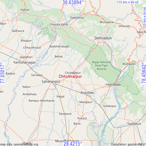
Chhutmalpur GPS coordinates[2]
30° 1' 55.524" North, 77° 45' 11.844" East
| Map corner | latitude | longitude |
|---|---|---|
| Upper-left | 30.63894°, | 77.05017° |
| Center: | 30.03209°, | 77.75329° |
| Lower-right: | 29.4215°, | 78.45642° |
| Map W x H: | 135.4×135.4 km | = 84.1×84.1mi |
| max Lat: | 34.9274° ⇑7.1% North |
| Chhutmalpur: | 30.03209° |
| min Lat: | ⇓92.9% South 8.09008° |
| min Long | Chhutmalpur | max Long |
| 68.82655° | 77.75329° | 96.81° |
| W 45.7%⇐ | ⇒54.3% E |
Elevation
Elevation of Chhutmalpur is 298 m = 978 ft, and this is 2.4 m = 8 ft above average elevation for this country.
| Max E: |
3681 m = 12077 ft | 33.5% |
| Chhutmalpur | 298 m 978 ft | |
| Avg. | 295.6 m = 970 ft | |
Min E: |
1 m = 3 ft | 66.5% |
See also: India elevation on elevation.city.
Geographical zone
Chhutmalpur is located in North temperate zone (between Tropic of Cancer and the Arctic Circle). Distance of this Northern Tropic circle is 733.3 km =455.7 mi to South.| Distance of | km | miles | from Chhutmalpur |
|---|---|---|---|
| North Pole | 6667.8 | 4143.2 | to North |
| Arctic Circle | 4061.9 | 2523.9 | to North |
| Tropic Cancer | 733.3 | 455.7 | to South |
| Equator | 3339.3 | 2074.9 | to South |


Nearby cities:
15 places around Chhutmalpur: (largest is in red/bold)
• Ambahta
44.7 km =27.8 mi,  244°
244°
• Behat
20.5 km =12.7 mi,  319°
319°
• Būriya
40.6 km =25.2 mi,  290°
290°
• Chhachhrauli
44.6 km =27.7 mi,  302°
302°
• Clement Town
35.6 km =22.1 mi,  43°
43°
• Dehra Dūn
42.2 km =26.2 mi, 39°
• Deoband
38.1 km =23.7 mi,  190°
190°
• Doiwāla
38.5 km =23.9 mi,  65°
65°
• Haridwar
40.3 km =25 mi,  103°
103°
• Laksar
41.2 km =25.6 mi,  137°
137°
• Manglaur
29.4 km =18.3 mi,  155°
155°
• Roorkee
22.7 km =14.1 mi, 144°
• Rāipur
44.8 km =27.8 mi,  46°
46°
• Rāmpur
38.4 km =23.9 mi,  229°
229°
• Sahāranpur
21.3 km =13.2 mi,  250°
250°
Sources, notices
• [Note1] Compared only with cities in India existing in our database
• [Src1] Map data: © OpenStreetMap contributors (CC-BY-SA)
• [Src2] Other city data from geonames.org with taken over terms of usage.
• [Src3] Geographical zone / Annual Mean Temperature by Robert A. Rohde @ Wikipedia
