Deoband geodata
Deoband (Uttar Pradesh) is a populated place; located in India in Asia/Kolkata (GMT+5.5) time zone. With population of 88,171 people, there are 506 cities with bigger population in this country. Compared to other cities in India, 91.8% of cities are located further ↓South; 55.3% of cities are located further →East and 61.8% of cities have lower elevation than Deoband. Note1


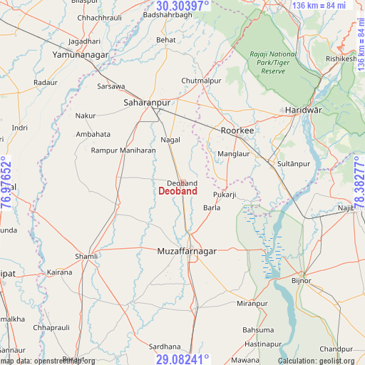
Deoband GPS coordinates[2]
29° 41' 42.18" North, 77° 40' 46.704" East
| Map corner | latitude | longitude |
|---|---|---|
| Upper-left | 30.30397°, | 76.97652° |
| Center: | 29.69505°, | 77.67964° |
| Lower-right: | 29.08241°, | 78.38277° |
| Map W x H: | 135.8×135.8 km | = 84.4×84.4mi |
| max Lat: | 34.9274° ⇑8.2% North |
| Deoband: | 29.69505° |
| min Lat: | ⇓91.8% South 8.09008° |
| min Long | Deoband | max Long |
| 68.82655° | 77.67964° | 96.81° |
| W 44.7%⇐ | ⇒55.3% E |
Elevation
Elevation of Deoband is 263 m = 863 ft, and this is 32.6 m = 107 ft below average elevation for this country.
| Max E: |
3681 m = 12077 ft | 38.2% |
| Avg. | 295.6 m = 970 ft | |
| Deoband | 263 m = 863 ft | |
Min E: |
1 m = 3 ft | 61.8% |
See also: Deoband elevation on elevation.city.
Geographical zone
Deoband is located in North temperate zone (between Tropic of Cancer and the Arctic Circle). Distance of this Northern Tropic circle is 695.9 km =432.4 mi to South.| Distance of | km | miles | from Deoband |
|---|---|---|---|
| North Pole | 6705.3 | 4166.5 | to North |
| Arctic Circle | 4099.4 | 2547.2 | to North |
| Tropic Cancer | 695.9 | 432.4 | to South |
| Equator | 3301.8 | 2051.6 | to South |


Nearby cities:
15 places around Deoband: (largest is in red/bold)
• Ambahta
37.8 km =23.5 mi,  298°
298°
• Charthāwal
18.4 km =11.4 mi,  206°
206°
• Chhutmalpur
38.1 km =23.7 mi,  10°
10°
• Garhi Pūkhta
39.3 km =24.4 mi,  245°
245°
• Jalālābad
24.8 km =15.4 mi, 249°
• Laksar
35.6 km =22.1 mi,  78°
78°
• Manglaur
21.9 km =13.6 mi,  60°
60°
• Muzaffarnagar
25 km =15.5 mi,  174°
174°
• Nanauta
25.4 km =15.8 mi,  274°
274°
• Roorkee
27.9 km =17.3 mi,  46°
46°
• Rāmpur
25.2 km =15.7 mi, 299°
• Sahāranpur
33 km =20.5 mi,  336°
336°
• Sisauli
37.3 km =23.2 mi, 213°
• Thāna Bhawan
28 km =17.4 mi,  244°
244°
• Titron
34.5 km =21.4 mi, 265°
Sources, notices
• [Note1] Compared only with cities in India existing in our database
• [Src1] Map data: © OpenStreetMap contributors (CC-BY-SA)
• [Src2] Other city data from geonames.org with taken over terms of usage.
• [Src3] Geographical zone / Annual Mean Temperature by Robert A. Rohde @ Wikipedia
