Al Ba‘āj geodata
Al Ba‘āj (Nineveh) is a seat of a second-order administrative division; located in Iraq in Asia/Baghdad (GMT+3) time zone. In our database, there are 71 cities with bigger population. Compared to other cities in Iraq, 73.2% of cities are located further ↓South; 98.6% of cities are located further →East and 66.9% of cities have lower elevation than Al Ba‘āj. Note1


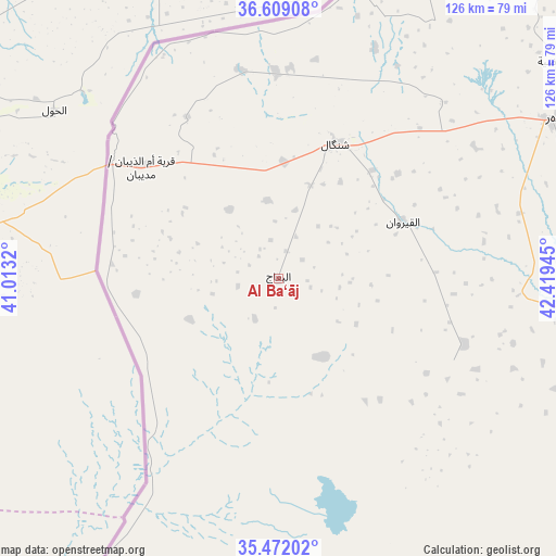
Al Ba‘āj GPS coordinates[2]
36° 2' 33.36" North, 41° 42' 58.752" East
| Map corner | latitude | longitude |
|---|---|---|
| Upper-left | 36.60908°, | 41.0132° |
| Center: | 36.0426°, | 41.71632° |
| Lower-right: | 35.47202°, | 42.41945° |
| Map W x H: | 126.4×126.4 km | = 78.5×78.5mi |
| max Lat: | 37.22781° ⇑26.8% North |
| Al Ba‘āj: | 36.0426° |
| min Lat: | ⇓73.2% South 29.97421° |
| min Long | Al Ba‘āj | max Long |
| 40.28586° | 41.71632° | 48.47309° |
| W 1.4%⇐ | ⇒98.6% E |
Elevation
Elevation of Al Ba‘āj is 317 m = 1040 ft, and this is 24 m = 79 ft above average elevation for this country.
| Max E: |
1316 m = 4318 ft | 33.1% |
| Al Ba‘āj | 317 m 1040 ft | |
| Avg. | 293 m = 961 ft | |
Min E: |
1 m = 3 ft | 66.9% |
See also: Iraq elevation on elevation.city.
Geographical zone
Al Ba‘āj is located in North temperate zone (between Tropic of Cancer and the Arctic Circle). Distance of this Northern Tropic circle is 1401.6 km =870.9 mi to South.| Distance of | km | miles | from Al Ba‘āj |
|---|---|---|---|
| North Pole | 5999.5 | 3727.9 | to North |
| Arctic Circle | 3393.6 | 2108.7 | to North |
| Tropic Cancer | 1401.6 | 870.9 | to South |
| Equator | 4007.6 | 2490.2 | to South |


Nearby cities:
15 places around Al Ba‘āj: (largest is in red/bold)
• Al Mawşil al Jadīdah
128.8 km =80 mi,  75°
75°
• Al Qayyārah
144.7 km =89.9 mi,  100°
100°
• Al Ḩaḑar
105.6 km =65.6 mi,  119°
119°
• Al-Hamdaniya
151.3 km =94 mi, 80°
• Ash Sharqāt
148.3 km =92.1 mi,  113°
113°
• Dihok
146.1 km =90.8 mi,  51°
51°
• Ibrāhīm al Khalīl
143.8 km =89.4 mi,  31°
31°
• Mosul
130 km =80.8 mi, 75°
• Saymayl
135.9 km =84.4 mi, 48°
• Sinjār
34.1 km =21.2 mi,  24°
24°
• Sīnah
145.8 km =90.6 mi, 54°
• Tall ‘Afar
75.6 km =47 mi,  60°
60°
• Tallkayf
135.5 km =84.2 mi,  68°
68°
• Zaxo
150.4 km =93.5 mi,  35°
35°
• Zaxu
149.6 km =93 mi, 35°
Sources, notices
• [Note1] Compared only with cities in Iraq existing in our database
• [Src1] Map data: © OpenStreetMap contributors (CC-BY-SA)
• [Src2] Other city data from geonames.org with taken over terms of usage.
• [Src3] Geographical zone / Annual Mean Temperature by Robert A. Rohde @ Wikipedia
