Al Mawşil al Jadīdah geodata
Al Mawşil al Jadīdah (Nineveh) is a section of populated place; located in Iraq in Asia/Baghdad (GMT+3) time zone. With population of 2,065,597 people, there are 2 cities with bigger population in this country. Compared to other cities in Iraq, 84.5% of cities are located further ↓South; 85.9% of cities are located further →East and 62.7% of cities have lower elevation than Al Mawşil al Jadīdah. Note1
Current local time in Al Mawşil al Jadīdah:
08:23 AM, WednesdayDifference from your time zone: hours


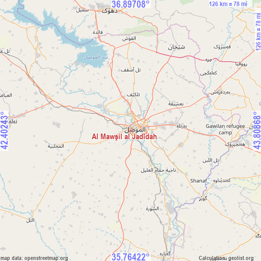
Al Mawşil al Jadīdah GPS coordinates[2]
36° 19' 57.756" North, 43° 6' 19.98" East
| Map corner | latitude | longitude |
|---|---|---|
| Upper-left | 36.89708°, | 42.40243° |
| Center: | 36.33271°, | 43.10555° |
| Lower-right: | 35.76422°, | 43.80868° |
| Map W x H: | 126×126 km | = 78.3×78.3mi |
| max Lat: | 37.22781° ⇑15.5% North |
| Al Mawşil al Jadīdah: | 36.33271° |
| min Lat: | ⇓84.5% South 29.97421° |
| min Long | Al Mawşil al J | max Long |
| 40.28586° | 43.10555° | 48.47309° |
| W 14.1%⇐ | ⇒85.9% E |
Elevation
Elevation of Al Mawşil al Jadīdah is 239 m = 784 ft, and this is 54 m = 177 ft below average elevation for this country.
| Max E: |
1316 m = 4318 ft | 37.3% |
| Avg. | 293 m = 961 ft | |
| Al Mawşil al Jadīdah | 239 m = 784 ft | |
Min E: |
1 m = 3 ft | 62.7% |
See also: Al Mawşil al Jadīdah elevation on elevation.city.
Geographical zone
Al Mawşil al Jadīdah is located in North temperate zone (between Tropic of Cancer and the Arctic Circle). Distance of this Northern Tropic circle is 1433.9 km =891 mi to South.| Distance of | km | miles | from Al Mawşil al Jadīdah |
|---|---|---|---|
| North Pole | 5967.2 | 3707.8 | to North |
| Arctic Circle | 3361.4 | 2088.7 | to North |
| Tropic Cancer | 1433.9 | 891 | to South |
| Equator | 4039.8 | 2510.2 | to South |


Nearby cities:
15 places around Al Mawşil al Jadīdah: (largest is in red/bold)
• Al Qayyārah
61.7 km =38.3 mi,  164°
164°
• Al-Hamdaniya
25.3 km =15.7 mi,  105°
105°
• Ash Shaykhān
46 km =28.6 mi,  28°
28°
• Beḧirke
83.3 km =51.8 mi,  91°
91°
• Dihok
60.3 km =37.5 mi,  350°
350°
• Erbil
82.9 km =51.5 mi,  101°
101°
• Mexmur
75.1 km =46.7 mi,  145°
145°
• Mosul
1.2 km =0.7 mi,  77°
77°
• Saymayl
62.8 km =39 mi,  338°
338°
• Sīnah
53.2 km =33.1 mi, 353°
• Tall ‘Afar
59.1 km =36.7 mi,  275°
275°
• Tallkayf
17.7 km =11 mi,  4°
4°
• Xebat
51 km =31.7 mi, 96°
• Zāwītah
63.8 km =39.6 mi, 3°
• ‘Aynkāwah
80.5 km =50 mi, 98°
Sources, notices
• [Note1] Compared only with cities in Iraq existing in our database
• [Src1] Map data: © OpenStreetMap contributors (CC-BY-SA)
• [Src2] Other city data from geonames.org with taken over terms of usage.
• [Src3] Geographical zone / Annual Mean Temperature by Robert A. Rohde @ Wikipedia
