Damāvand geodata
Damāvand (Tehrān) is a seat of a second-order administrative division; located in Iran in Asia/Tehran (GMT+3.5) time zone. With population of 29,144 people, there are 177 cities with bigger population in this country. Compared to other cities in Iran, 65.8% of cities are located further ↓South; 59.4% of cities are located further ←West and 93% of cities have lower elevation than Damāvand. Note1


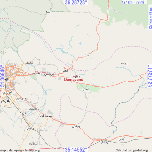
Damāvand GPS coordinates[2]
35° 43' 6.312" North, 52° 4' 10.488" East
| Map corner | latitude | longitude |
|---|---|---|
| Upper-left | 36.28723°, | 51.36646° |
| Center: | 35.71842°, | 52.06958° |
| Lower-right: | 35.14552°, | 52.77271° |
| Map W x H: | 126.9×126.9 km | = 78.9×78.9mi |
| max Lat: | 39.6482° ⇑34.2% North |
| Damāvand: | 35.71842° |
| min Lat: | ⇓65.8% South 25.2919° |
| min Long | Damāvand | max Long |
| 44.38416° | 52.06958° | 61.9965° |
| W 59.4%⇐ | ⇒40.6% E |
Elevation
Elevation of Damāvand is 1959 m = 6427 ft, and this is 910 m = 2986 ft above average elevation for this country.
| Max E: |
2564 m = 8412 ft | 7% |
| Damāvand | 1959 m 6427 ft | |
| Avg. | 1049 m = 3442 ft | |
Min E: |
-24 m = -79 ft | 93% |
See also: Iran elevation on elevation.city.
Geographical zone
Damāvand is located in North temperate zone (between Tropic of Cancer and the Arctic Circle). Distance of this Northern Tropic circle is 1365.6 km =848.5 mi to South.| Distance of | km | miles | from Damāvand |
|---|---|---|---|
| North Pole | 6035.5 | 3750.3 | to North |
| Arctic Circle | 3429.7 | 2131.1 | to North |
| Tropic Cancer | 1365.6 | 848.5 | to South |
| Equator | 3971.5 | 2467.8 | to South |


Nearby cities:
15 places around Damāvand: (largest is in red/bold)
• Eqbālīyeh
66.9 km =41.6 mi,  226°
226°
• Fīrūzkūh
63.4 km =39.4 mi,  86°
86°
• Garmsār
60.8 km =37.8 mi,  156°
156°
• Pākdasht
43.9 km =27.3 mi, 232°
• Pīshvā
55.2 km =34.3 mi,  214°
214°
• Qarchak
55.1 km =34.2 mi, 234°
• Rey
58.6 km =36.4 mi,  256°
256°
• Sharīfābād
41.3 km =25.7 mi,  218°
218°
• Soleh Bon
44.7 km =27.8 mi,  82°
82°
• Tajrīsh
58.9 km =36.6 mi,  279°
279°
• Tehran
58.6 km =36.4 mi,  267°
267°
• Varāmīn
58.2 km =36.2 mi, 221°
• Ārādān
64.8 km =40.3 mi,  143°
143°
• Īstgāh-e Rāh Āhan-e Garmsār
58 km =36 mi, 158°
• Ţāleb ābād
54.3 km =33.7 mi,  243°
243°
Sources, notices
• [Note1] Compared only with cities in Iran existing in our database
• [Src1] Map data: © OpenStreetMap contributors (CC-BY-SA)
• [Src2] Other city data from geonames.org with taken over terms of usage.
• [Src3] Geographical zone / Annual Mean Temperature by Robert A. Rohde @ Wikipedia
