Rasht geodata
Rasht (Gīlān) is a seat of a first-order administrative division; located in Iran in Asia/Tehran (GMT+3.5) time zone. With population of 594,590 people, there are 11 cities with bigger population in this country. Compared to other cities in Iran, 88.7% of cities are located further ↓South; 65.8% of cities are located further →East and 95% of cities have higher elevation than Rasht. Note1


Rasht GPS coordinates[2]
37° 16' 33.996" North, 49° 35' 19.032" East
| Map corner | latitude | longitude |
|---|---|---|
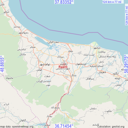
| Upper-left | 37.83352°, | 48.8855° |
| Center: | 37.27611°, | 49.58862° |
| Lower-right: | 36.71454°, | 50.29175° |
| Map W x H: | 124.4×124.4 km | = 77.3×77.3mi |
| max Lat: | 39.6482° ⇑11.3% North |
| Rasht: | 37.27611° |
| min Lat: | ⇓88.7% South 25.2919° |
| min Long | Rasht | max Long |
| 44.38416° | 49.58862° | 61.9965° |
| W 34.2%⇐ | ⇒65.8% E |
Elevation
Elevation of Rasht is 4 m = 13 ft, and this is 1045 m = 3428 ft below average elevation for this country.
| Max E: |
2564 m = 8412 ft | 95% |
| Avg. | 1049 m = 3442 ft | |
| Rasht | 4 m = 13 ft | |
Min E: |
-24 m = -79 ft | 5% |
See also: Rasht elevation on elevation.city.
Geographical zone
Rasht is located in North temperate zone (between Tropic of Cancer and the Arctic Circle). Distance of this Northern Tropic circle is 1538.8 km =956.2 mi to South.| Distance of | km | miles | from Rasht |
|---|---|---|---|
| North Pole | 5862.3 | 3642.7 | to North |
| Arctic Circle | 3256.5 | 2023.5 | to North |
| Tropic Cancer | 1538.8 | 956.2 | to South |
| Equator | 4144.7 | 2575.4 | to South |


Nearby cities:
15 places around Rasht: (largest is in red/bold)
• Amlash
56.6 km =35.2 mi,  110°
110°
• Bandar-e Anzalī
24.8 km =15.4 mi,  332°
332°
• Fūman
25.1 km =15.6 mi,  256°
256°
• Langarūd
50.7 km =31.5 mi,  100°
100°
• Lāhījān
38.1 km =23.7 mi, 102°
• Māsāl
41.4 km =25.7 mi,  283°
283°
• Māsūleh
54.7 km =34 mi, 255°
• Pādegān-e Manjīl
61.4 km =38.2 mi,  194°
194°
• Pā’īn-e Bāzār-e Rūdbār
52.6 km =32.7 mi,  195°
195°
• Reẕvānshahr
50.2 km =31.2 mi,  307°
307°
• Shaft
20.4 km =12.7 mi,  234°
234°
• Sīāhkal
28.5 km =17.7 mi,  118°
118°
• Ziabar (Gaskar)
34.6 km =21.5 mi,  298°
298°
• Āstāneh-ye Ashrafīyeh
31.4 km =19.5 mi,  92°
92°
• Şowme‘eh Sarā
24.4 km =15.2 mi, 276°
Sources, notices
• [Note1] Compared only with cities in Iran existing in our database
• [Src1] Map data: © OpenStreetMap contributors (CC-BY-SA)
• [Src2] Other city data from geonames.org with taken over terms of usage.
• [Src3] Geographical zone / Annual Mean Temperature by Robert A. Rohde @ Wikipedia
