Pā’īn-e Bāzār-e Rūdbār geodata
Pā’īn-e Bāzār-e Rūdbār (Gīlān) is a seat of a second-order administrative division; located in Iran in Asia/Tehran (GMT+3.5) time zone. In our database, there are 232 cities with bigger population. Compared to other cities in Iran, 80.7% of cities are located further ↓South; 66.9% of cities are located further →East and 78.9% of cities have higher elevation than Pā’īn-e Bāzār-e Rūdbār. Note1
Current local time in Pā’īn-e Bāzār-e Rūdbār:
02:06 PM, TuesdayDifference from your time zone: hours


Pā’īn-e Bāzār-e Rūdbār GPS coordinates[2]
36° 49' 15.96" North, 49° 25' 35.04" East
| Map corner | latitude | longitude |
|---|---|---|
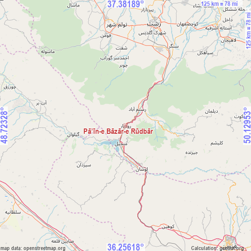
| Upper-left | 37.38189°, | 48.72328° |
| Center: | 36.8211°, | 49.4264° |
| Lower-right: | 36.25618°, | 50.12953° |
| Map W x H: | 125.2×125.2 km | = 77.8×77.8mi |
| max Lat: | 39.6482° ⇑19.3% North |
| Pā’īn-e Bāzār-e Rūdbār: | 36.8211° |
| min Lat: | ⇓80.7% South 25.2919° |
| min Long | Pā’īn-e Bā | max Long |
| 44.38416° | 49.4264° | 61.9965° |
| W 33.1%⇐ | ⇒66.9% E |
Elevation
Elevation of Pā’īn-e Bāzār-e Rūdbār is 204 m = 669 ft, and this is 845 m = 2772 ft below average elevation for this country.
| Max E: |
2564 m = 8412 ft | 78.9% |
| Avg. | 1049 m = 3442 ft | |
| Pā’īn-e Bāzār-e Rūdbār | 204 m = 669 ft | |
Min E: |
-24 m = -79 ft | 21.1% |
See also: Iran elevation on elevation.city.
Geographical zone
Pā’īn-e Bāzār-e Rūdbār is located in North temperate zone (between Tropic of Cancer and the Arctic Circle). Distance of this Northern Tropic circle is 1488.2 km =924.7 mi to South.| Distance of | km | miles | from Pā’īn-e Bāzār-e Rūdbār |
|---|---|---|---|
| North Pole | 5912.9 | 3674.1 | to North |
| Arctic Circle | 3307.1 | 2054.9 | to North |
| Tropic Cancer | 1488.2 | 924.7 | to South |
| Equator | 4094.1 | 2544 | to South |


Nearby cities:
15 places around Pā’īn-e Bāzār-e Rūdbār: (largest is in red/bold)
• Alvand
60.4 km =37.5 mi,  202°
202°
• Bandar-e Anzalī
72.6 km =45.1 mi,  2°
2°
• Fūman
45.9 km =28.5 mi,  347°
347°
• Khorramdarreh
71.3 km =44.3 mi, 196°
• Lāhījān
67 km =41.6 mi,  50°
50°
• Māsāl
65.6 km =40.8 mi,  336°
336°
• Māsūleh
53.7 km =33.4 mi,  313°
313°
• Pādegān-e Manjīl
8.9 km =5.5 mi,  185°
185°
• Rasht
52.6 km =32.7 mi,  15°
15°
• Shaft
38.9 km =24.2 mi,  356°
356°
• Sīāhkal
54.1 km =33.6 mi, 46°
• Ziabar (Gaskar)
69.1 km =42.9 mi, 346°
• Ābbar
43.2 km =26.8 mi,  285°
285°
• Āstāneh-ye Ashrafīyeh
67.2 km =41.8 mi,  43°
43°
• Şowme‘eh Sarā
54.3 km =33.7 mi, 349°
Sources, notices
• [Note1] Compared only with cities in Iran existing in our database
• [Src1] Map data: © OpenStreetMap contributors (CC-BY-SA)
• [Src2] Other city data from geonames.org with taken over terms of usage.
• [Src3] Geographical zone / Annual Mean Temperature by Robert A. Rohde @ Wikipedia
