Māsūleh geodata
Māsūleh (Gīlān) is a populated place; located in Iran in Asia/Tehran (GMT+3.5) time zone. With population of 554 people, there are 231 cities with bigger population in this country. Compared to other cities in Iran, 85.9% of cities are located further ↓South; 71.7% of cities are located further →East and 60.5% of cities have higher elevation than Māsūleh. Note1


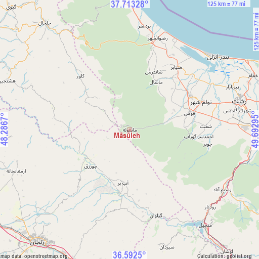
Māsūleh GPS coordinates[2]
37° 9' 17.892" North, 48° 59' 23.352" East
| Map corner | latitude | longitude |
|---|---|---|
| Upper-left | 37.71328°, | 48.2867° |
| Center: | 37.15497°, | 48.98982° |
| Lower-right: | 36.5925°, | 49.69295° |
| Map W x H: | 124.6×124.6 km | = 77.4×77.4mi |
| max Lat: | 39.6482° ⇑14.1% North |
| Māsūleh: | 37.15497° |
| min Lat: | ⇓85.9% South 25.2919° |
| min Long | Māsūleh | max Long |
| 44.38416° | 48.98982° | 61.9965° |
| W 28.3%⇐ | ⇒71.7% E |
Elevation
Elevation of Māsūleh is 970 m = 3182 ft, and this is 79 m = 259 ft below average elevation for this country.
| Max E: |
2564 m = 8412 ft | 60.5% |
| Avg. | 1049 m = 3442 ft | |
| Māsūleh | 970 m = 3182 ft | |
Min E: |
-24 m = -79 ft | 39.5% |
See also: Iran elevation on elevation.city.
Geographical zone
Māsūleh is located in North temperate zone (between Tropic of Cancer and the Arctic Circle). Distance of this Northern Tropic circle is 1525.3 km =947.8 mi to South.| Distance of | km | miles | from Māsūleh |
|---|---|---|---|
| North Pole | 5875.8 | 3651.1 | to North |
| Arctic Circle | 3269.9 | 2031.8 | to North |
| Tropic Cancer | 1525.3 | 947.8 | to South |
| Equator | 4131.2 | 2567 | to South |


Nearby cities:
15 places around Māsūleh: (largest is in red/bold)
• Bandar-e Anzalī
54.5 km =33.9 mi,  49°
49°
• Fūman
29.6 km =18.4 mi,  74°
74°
• Hashtpar
71.7 km =44.6 mi,  354°
354°
• Khalkhāl
65.7 km =40.8 mi,  321°
321°
• Māsāl
26.4 km =16.4 mi,  28°
28°
• Pādegān-e Manjīl
59.6 km =37 mi,  140°
140°
• Pā’īn-e Bāzār-e Rūdbār
53.7 km =33.4 mi,  133°
133°
• Rasht
54.7 km =34 mi,  75°
75°
• Reẕvānshahr
45.8 km =28.5 mi,  16°
16°
• Shaft
36.4 km =22.6 mi,  87°
87°
• Sīāhkal
78.1 km =48.5 mi, 90°
• Zanjān
69 km =42.9 mi,  219°
219°
• Ziabar (Gaskar)
37.7 km =23.4 mi,  36°
36°
• Ābbar
25.6 km =15.9 mi,  186°
186°
• Şowme‘eh Sarā
33.1 km =20.6 mi,  60°
60°
Sources, notices
• [Note1] Compared only with cities in Iran existing in our database
• [Src1] Map data: © OpenStreetMap contributors (CC-BY-SA)
• [Src2] Other city data from geonames.org with taken over terms of usage.
• [Src3] Geographical zone / Annual Mean Temperature by Robert A. Rohde @ Wikipedia
